MyTopo
Hewlett Virginia US Topo Map
Couldn't load pickup availability
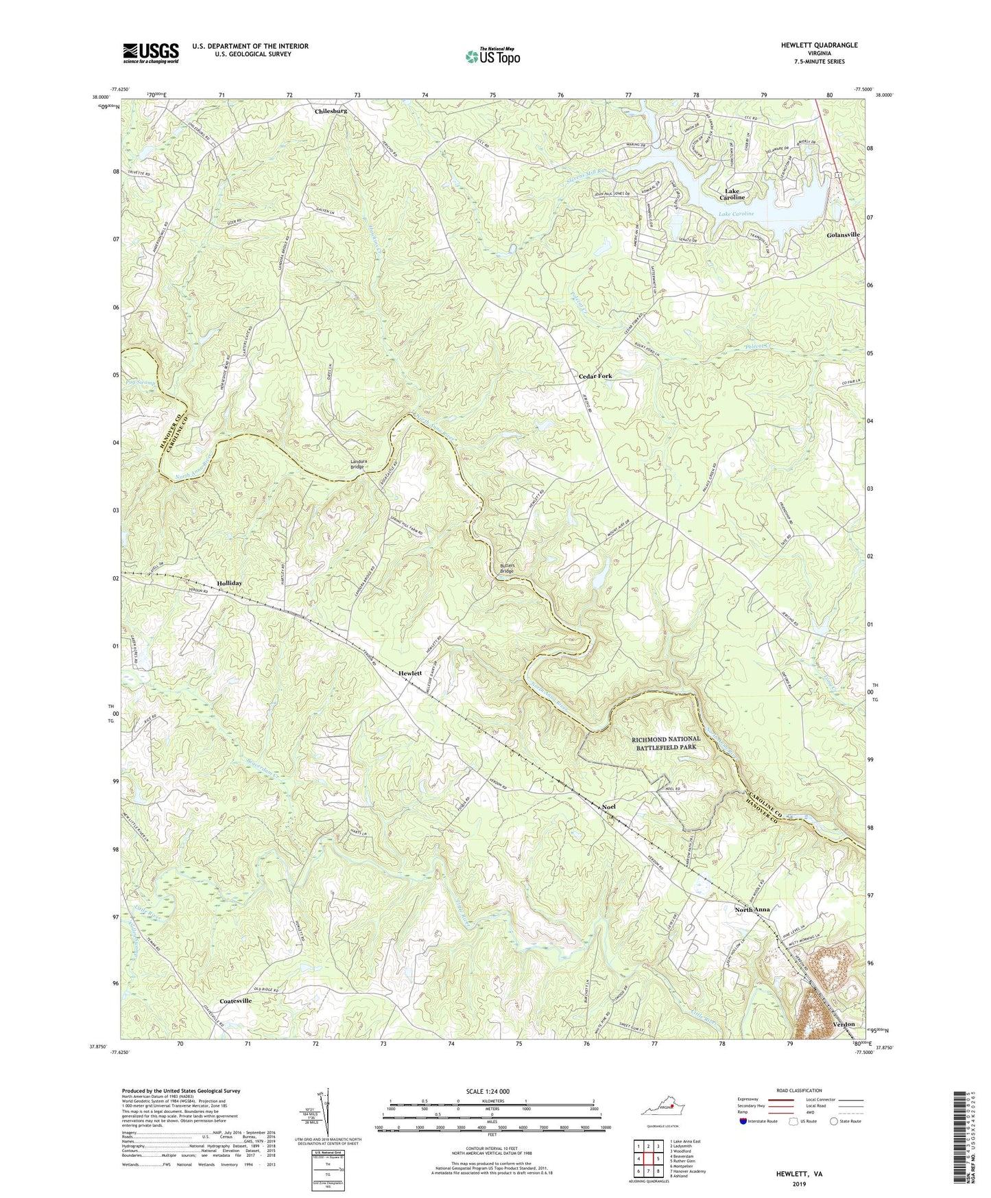
2022 topographic map quadrangle Hewlett in the state of Virginia. Scale: 1:24000. Based on the newly updated USGS 7.5' US Topo map series, this map is in the following counties: Caroline, Hanover. The map contains contour data, water features, and other items you are used to seeing on USGS maps, but also has updated roads and other features. This is the next generation of topographic maps. Printed on high-quality waterproof paper with UV fade-resistant inks.
Quads adjacent to this one:
West: Beaverdam
Northwest: Lake Anna East
North: Ladysmith
Northeast: Woodford
East: Ruther Glen
Southeast: Ashland
South: Hanover Academy
Southwest: Montpelier
This map covers the same area as the classic USGS quad with code o37077h5.
Contains the following named places: Beaverdam Creek, Butlers Bridge, Cedar Fork, Chilesburg, Coatesville, Coffey Corner, Colley Swamp, Doswell Quarry, Elon Church, Golansville, Hawkins Creek, Hewlett, Holliday, Houstons Corner, Lake Caroline, Lake Caroline Census Designated Place, Lake Caroline Dam, Landora Bridge, Mount Carmel Church, Mount Hewlett School, Mount Salem Church, Noel, North Anna, Ottley Mill, Pug Swamp, Saint James Church, United Church, USRY Properties Incorporated Dam, Verdon