MyTopo
Salisbury Virginia US Topo Map
Couldn't load pickup availability
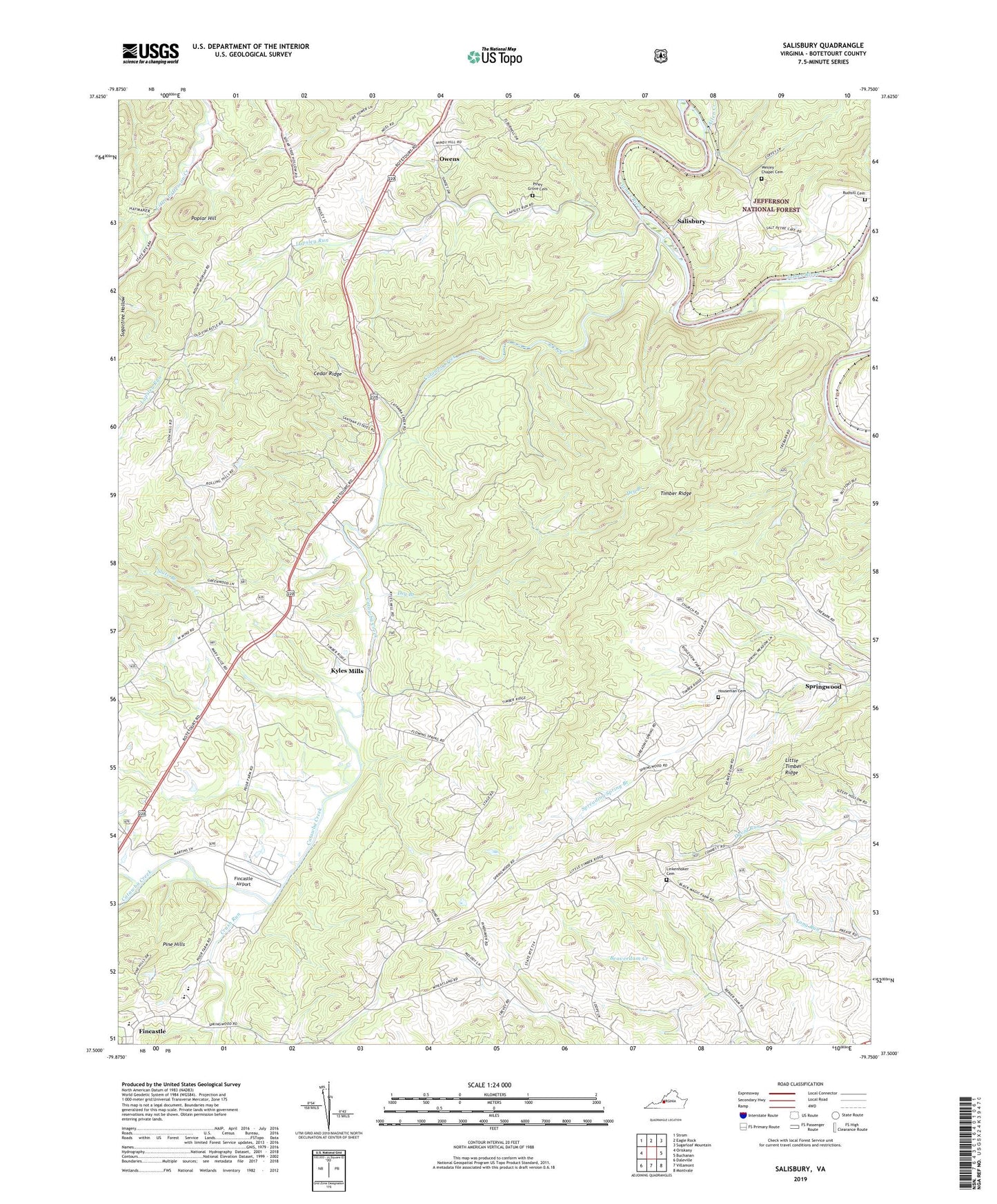
2019 topographic map quadrangle Salisbury in the state of Virginia. Scale: 1:24000. Based on the newly updated USGS 7.5' US Topo map series, this map is in the following counties: Botetourt. The map contains contour data, water features, and other items you are used to seeing on USGS maps, but also has updated roads and other features. This is the next generation of topographic maps. Printed on high-quality waterproof paper with UV fade-resistant inks.
Quads adjacent to this one:
West: Oriskany
Northwest: Strom
North: Eagle Rock
Northeast: Sugarloaf Mountain
East: Buchanan
Southeast: Montvale
South: Villamont
Southwest: Daleville
Contains the following named places: Allen Creek, Andrew Chapel, Bearwallow School, Botetourt, Botetourt County, Botetourt Technical Education Center, Breckinridge Elementary School, Burkeston, Catawba Creek, Cedar Ridge, Central Academy Middle School, Comptons Bridge, Crush Run, Dry Branch, Faith Church, Fincastle Airport, Forest Grove Church, Forest Grove School, High View School, Houseman Cemetery, Kyles Mills, Lapsley Run, Lapsley Run Church, Lily of the Valley Church, Linkenhoker Cemetery, Little Timber Ridge, Mount Moriah Church, New Hope Church, Oak Grove School, Owens, Pierce Chapel, Pine Hills, Piney Grove Cemetery, Poplar Grove School, Poplar Hill, Rudisill Cemetery, Saint Jacobs Church, Salisbury, Salisbury Furnace, Slate Branch, Timber Ridge, Town of Fincastle, Valley School, Wesley Chapel Cemetery, Wheatland Church, Zion Hill Church