MyTopo
Scottsburg Virginia US Topo Map
Couldn't load pickup availability
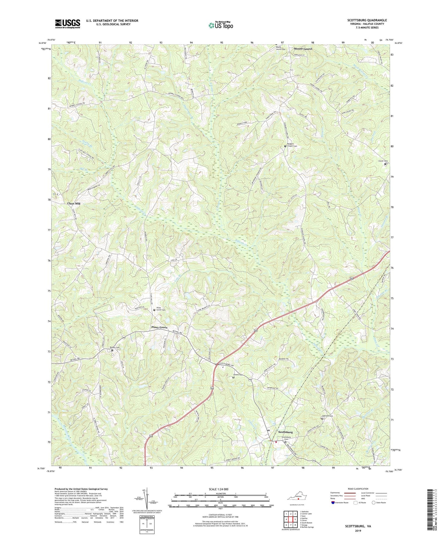
2019 topographic map quadrangle Scottsburg in the state of Virginia. Scale: 1:24000. Based on the newly updated USGS 7.5' US Topo map series, this map is in the following counties: Halifax. The map contains contour data, water features, and other items you are used to seeing on USGS maps, but also has updated roads and other features. This is the next generation of topographic maps. Printed on high-quality waterproof paper with UV fade-resistant inks.
Quads adjacent to this one:
West: Halifax
Northwest: Nathalie
North: Conner Lake
Northeast: Saxe
East: Clover
Southeast: Buffalo Springs
South: Omega
Southwest: South Boston
Contains the following named places: Alpha Hotel Airport, Andrew Farmer School, Bagwell Dam, Bethel Cemetery, Bethel Church, Burton Dam, Clays Mill, Clays Mill Elementary School, Cliborne Dam, Clover Cemetery, Double Branch, East Prong, Ellen Mitchell School, J T Burton Dam, Long Branch, Midway, Mill Branch, Mount Laurel United Methodist Church, Oakland Cemetery, Opossum Branch, Owens Cemetery, Piney Creek, Piney Grove, Piney Grove Baptist Church, Piney Grove Cemetery, Reese Farms, Rodgers Chapel Cemetery, Rodges Chapel, Saint James Church, Scottsburg, Scottsburg Baptist Church, Scottsburg Cemetery, Scottsburg Elementary School, Scottsburg Post Office, Scottsburg Volunteer Fire Department, Smallmans Branch, Tanyard Branch, Town of Scottsburg, ZIP Codes: 24534, 24589