MyTopo
Buffalo Springs Virginia US Topo Map
Couldn't load pickup availability
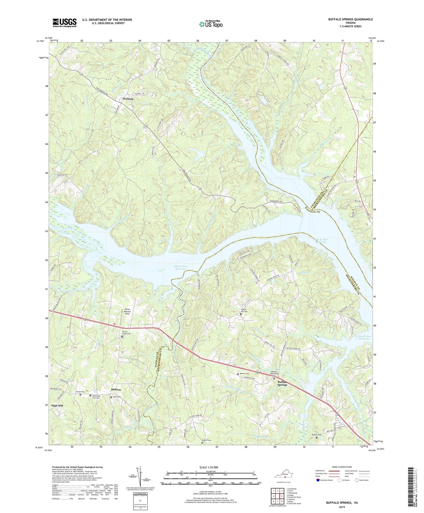
2022 topographic map quadrangle Buffalo Springs in the state of Virginia. Scale: 1:24000. Based on the newly updated USGS 7.5' US Topo map series, this map is in the following counties: Halifax, Mecklenburg, Charlotte. The map contains contour data, water features, and other items you are used to seeing on USGS maps, but also has updated roads and other features. This is the next generation of topographic maps. Printed on high-quality waterproof paper with UV fade-resistant inks.
Quads adjacent to this one:
West: Omega
Northwest: Scottsburg
North: Clover
Northeast: Wylliesburg
East: Clarksville North
Southeast: Clarksville South
South: Nelson
Southwest: Virgilina
This map covers the same area as the classic USGS quad with code o36078f6.
Contains the following named places: Aaron Penston Field, Aarons Creek, Aarons Creek Baptist Church, Aarons Creek Cemetery, Abbeville Mill, Bagbys Ferry, Big Level Church, Big River Ranch Airport, Blanks Cemetery, Bowen Cemetery, Buffalo Baptist Tabernacle, Buffalo Baptist Tabernacle Cemetery, Buffalo Cemetery, Buffalo Church, Buffalo Public Use Area, Buffalo Springs, Buffalo Springs School, Buffalo Wildlife Management Area, Cargills Creek, Cargills Creek Wildlife Management Area, Carters Point, Cherry Branch, Cherry Hill Church, Clays Quarry, Difficult Creek, Dryburg, Dyer Cemetery, Eastern Pines Dam, Elliot Branch, Fairview Acres, Flat Branch, Flat Rock Branch, Fleming Corner, Gravel Hill Cemetery, Gravel Hill Church, Gravel Hill School, High Hill, Hog Island, Hogan Creek, Hogan Creek Wildlife Management Area, Hyco Falls, Hyco River, Jamison Branch, Jeffreys Chute, Laconia, Line Branch, Little Buffalo Creek, Lower Banks Creek, Marble Yard Shoals, Midway, Midway Volunteer Fire Department, Millstone Branch, Morris Branch, Nelsons Island, North Fork, Number Three Branch, Oak Level School, Peter Creek, Pools Mill, Saint Marks Church, Saint Marks School, Saw Mill Branch, Snead Cemetery, Spanish Grove Church, Staunton River State Park, Staunton View Public Use Area, Tanyard Branch, Tomtit Branch, Walker Branch, White Oak Fork Cemetery, ZIP Code: 24529