MyTopo
Sebrell Virginia US Topo Map
Couldn't load pickup availability
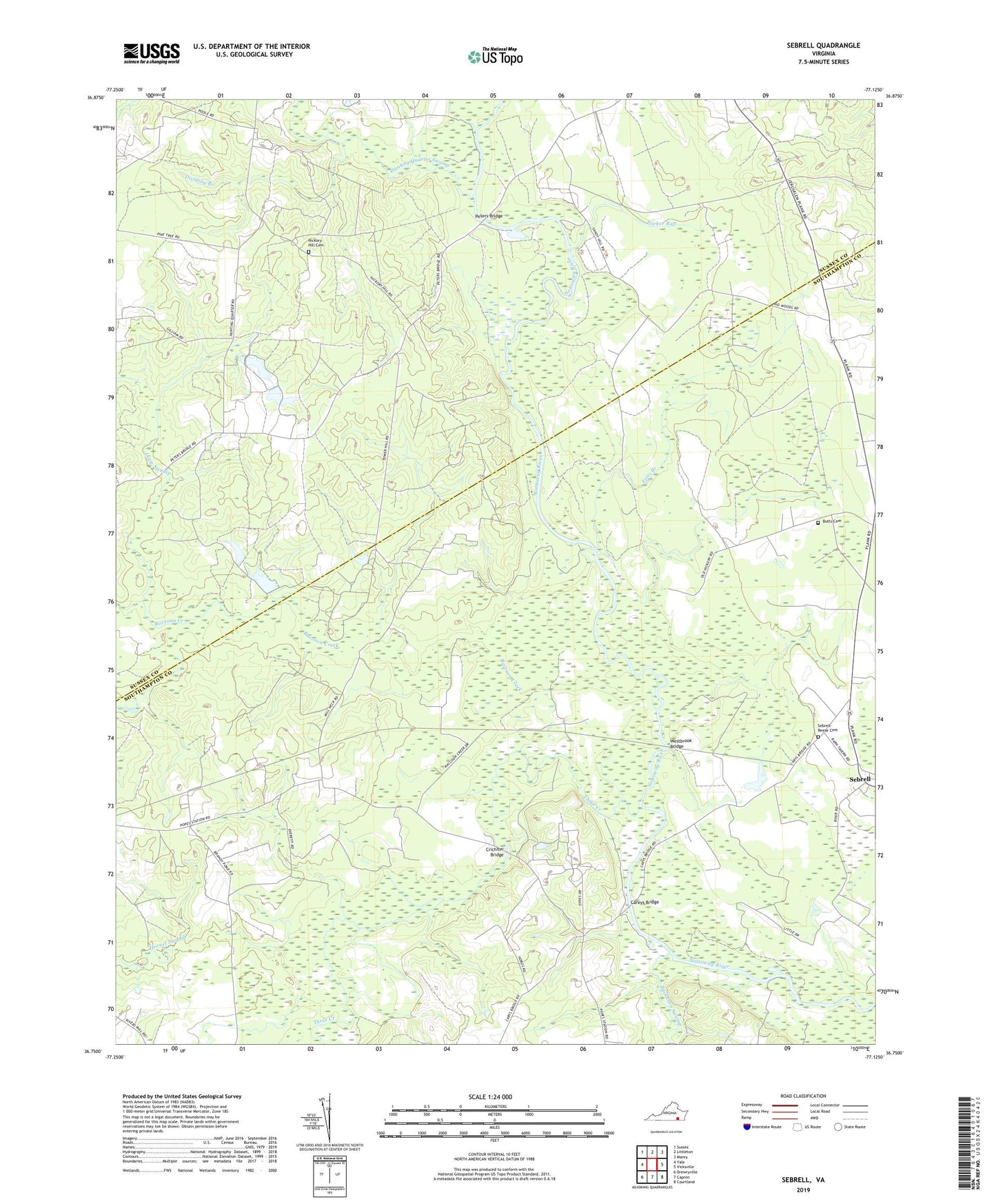
2019 topographic map quadrangle Sebrell in the state of Virginia. Scale: 1:24000. Based on the newly updated USGS 7.5' US Topo map series, this map is in the following counties: Southampton, Sussex. The map contains contour data, water features, and other items you are used to seeing on USGS maps, but also has updated roads and other features. This is the next generation of topographic maps. Printed on high-quality waterproof paper with UV fade-resistant inks.
Quads adjacent to this one:
West: Yale
Northwest: Sussex
North: Littleton
Northeast: Manry
East: Vicksville
Southeast: Courtland
South: Capron
Southwest: Drewryville
Contains the following named places: Applewhite Church, Bethel Star Church, Blows Chapel, Buckhorn Swamp, Butts Cemetery, Careys Bridge, Chub, Cooper School, Coopers School, Crichton Bridge, Dividing Branch, Felts Branch, Hickory Hill Cemetery, Hickory Hill Church, Hickory Hill School, Hornet Swamp, Hunting Quarter Plantation, Hunting Quarter Swamp, Jones School, Little Swamp, Mill Neck Church, Nicholson School, Parker Run, Peters Bridge, Pleasant Grove Church, Raccoon Creek, Saint Johns Church, Saint Marks Church, Sebrell, Sebrell-Reese Cemetery, Spring Creek, Three Creek, Westbrook Bridge, Westbrooks Bridge