MyTopo
Snow Creek Virginia US Topo Map
Couldn't load pickup availability
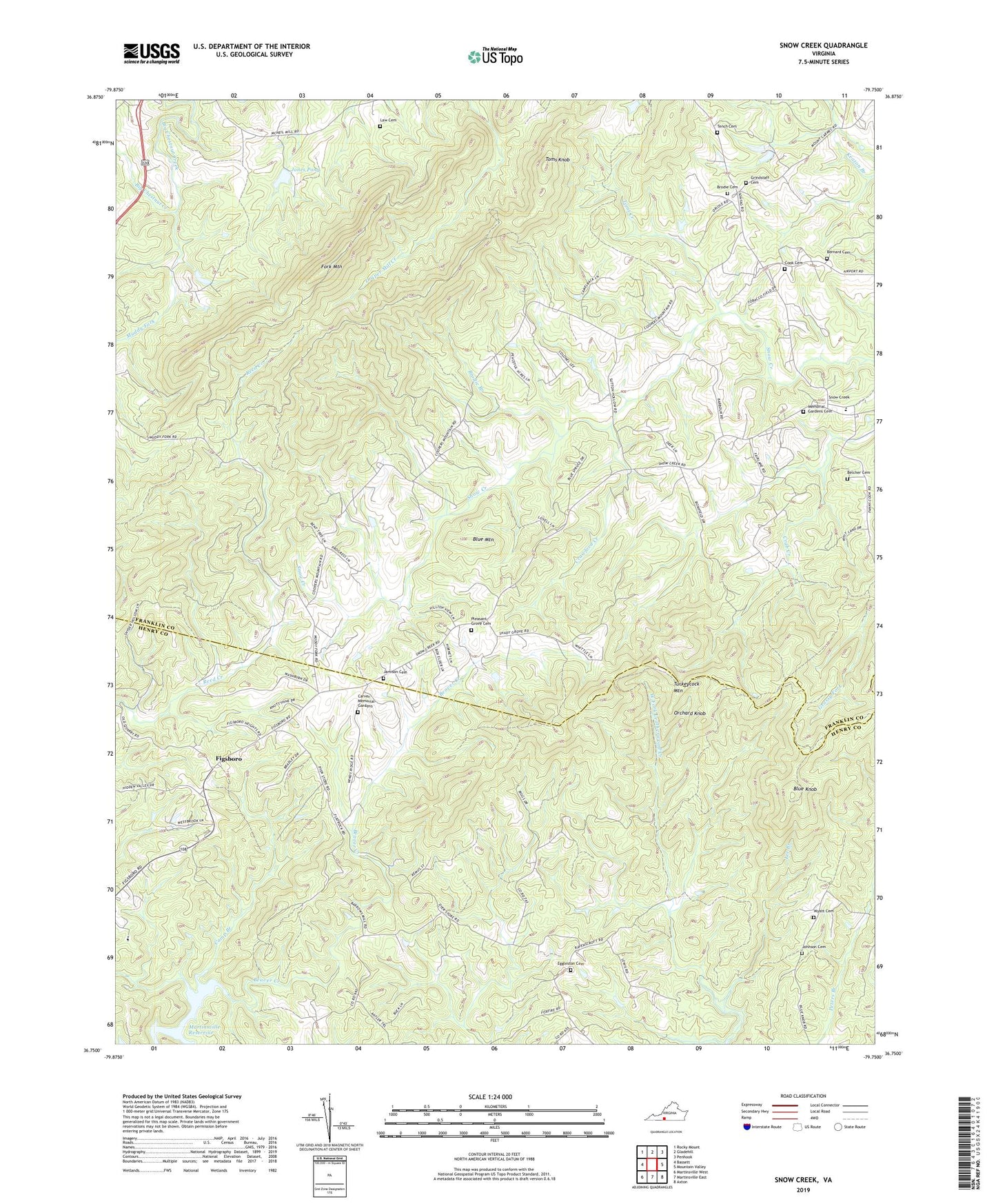
2022 topographic map quadrangle Snow Creek in the state of Virginia. Scale: 1:24000. Based on the newly updated USGS 7.5' US Topo map series, this map is in the following counties: Franklin, Henry. The map contains contour data, water features, and other items you are used to seeing on USGS maps, but also has updated roads and other features. This is the next generation of topographic maps. Printed on high-quality waterproof paper with UV fade-resistant inks.
Quads adjacent to this one:
West: Bassett
Northwest: Rocky Mount
North: Gladehill
Northeast: Penhook
East: Mountain Valley
Southeast: Axton
South: Martinsville East
Southwest: Martinsville West
This map covers the same area as the classic USGS quad with code o36079g7.
Contains the following named places: Barrows Mill School, Belcher Cemetery, Belchers Mill, Bernard Cemetery, Blue Hill Church, Blue Knob, Blue Mountain, Brodie Branch, Brodie Cemetery, Camp Branch, Camp Branch Church, Carver Memorial Gardens, Casters Trail, Center for Community Learning, Cook Cemetery, Crawford Creek, Dyers Store, Dyers Store School, Eggleston Cemetery, Fairview Church, Figsboro, Flatrock Church, Flatrock School, Fork Mountain, Grindstaff Cemetery, Hundley - Beckner Cemetery, Hunley School, Jamison Cemetery, Johnson Cemetery, Jones Dam, Jones Pond, Law Cemetery, Lee Branch, Mountain School, Muddy Fork, Niblett Hill School, Orchard Knob, Pleasant Grove Cemetery, Pleasant Grove Church, Shady Grove School, Snow Creek, Snow Creek Church, Snow Creek Elementary School, Snow Creek Memorial Gardens, Snow Creek School, Sunnyview School, Tench Cemetery, Toms Creek, Toms Knob, Trinity Church, Twin Oaks Dairy Farm, Wyatt Cemetery