
MyTopo
Spring Garden Virginia US Topo Map
Couldn't load pickup availability
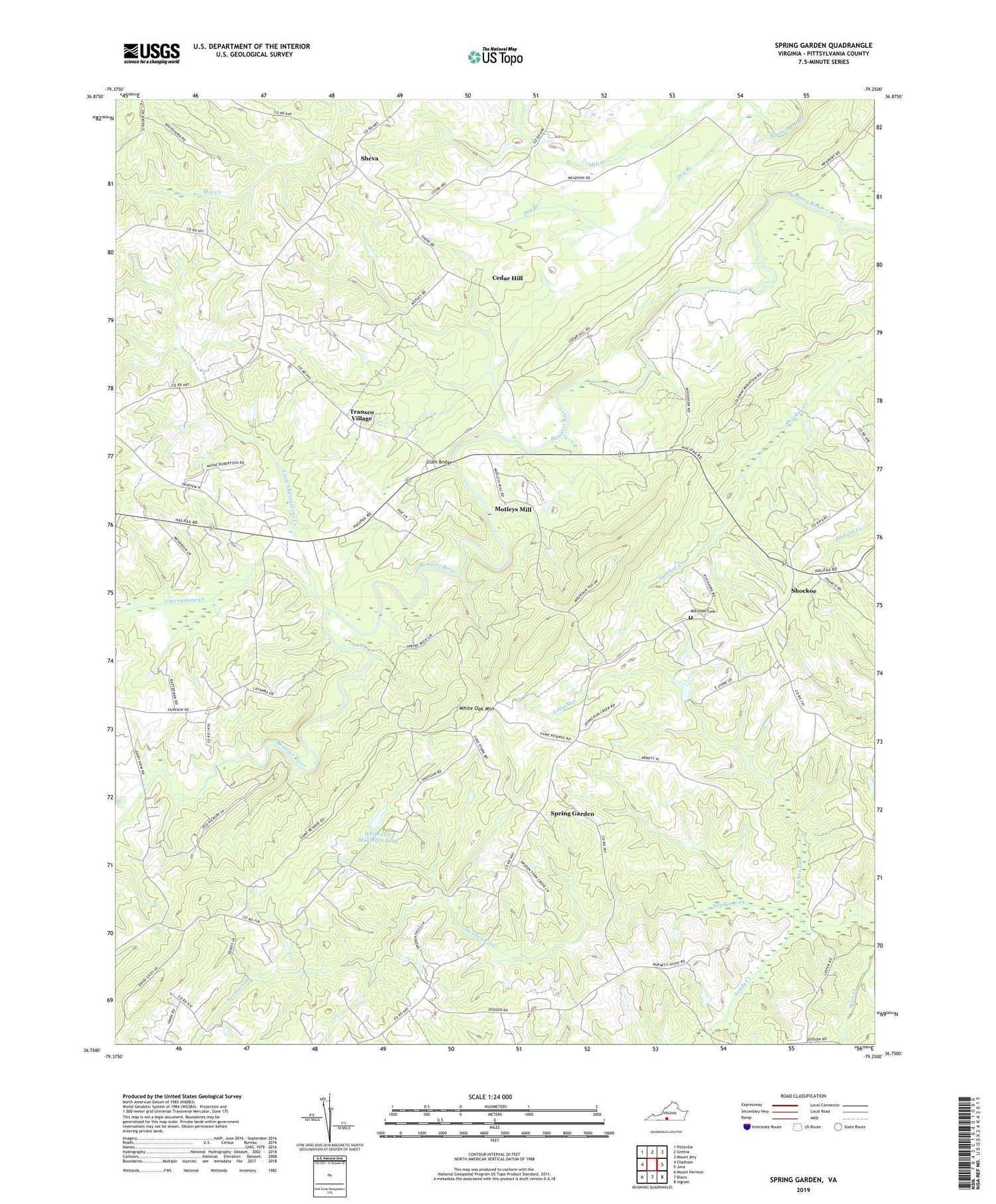
2019 topographic map quadrangle Spring Garden in the state of Virginia. Scale: 1:24000. Based on the newly updated USGS 7.5' US Topo map series, this map is in the following counties: Pittsylvania. The map contains contour data, water features, and other items you are used to seeing on USGS maps, but also has updated roads and other features. This is the next generation of topographic maps. Printed on high-quality waterproof paper with UV fade-resistant inks.
Quads adjacent to this one:
West: Chatham
Northwest: Pittsville
North: Gretna
Northeast: Mount Airy
East: Java
Southeast: Ingram
South: Blairs
Southwest: Mount Hermon
Contains the following named places: Atkinson Cemetery, Banister District, Banister School, C B Firth Dam, Cedar Hill, Cherrystone Creek, Chestnut Level Church, Clark Bridge, Dodson Corners, Dry Branch, Fairview Chapel, Hood Dam, Hood Lake, Johns Run, Little Cherrystone Creek, Mill Creek Church, Mill Creek School, Motleys Mill, Mountain Spring Church, New Mine Creek Church, Pittsylvania Church Camp, Robinson Bridge, Sheva, Shockoe, Shockoe Baptist Church, Shockoe School, Singers Grove School, Smithfield Church, Sonans School, Spring Garden, Sweden Fork, Transco Village, Walnut Winds Farm, Wayside School, White Oak Mountain Dam, White Oak Mountain Lake, White Oak Mountain Wildlife Management Area


