MyTopo
Pittsville Virginia US Topo Map
Couldn't load pickup availability
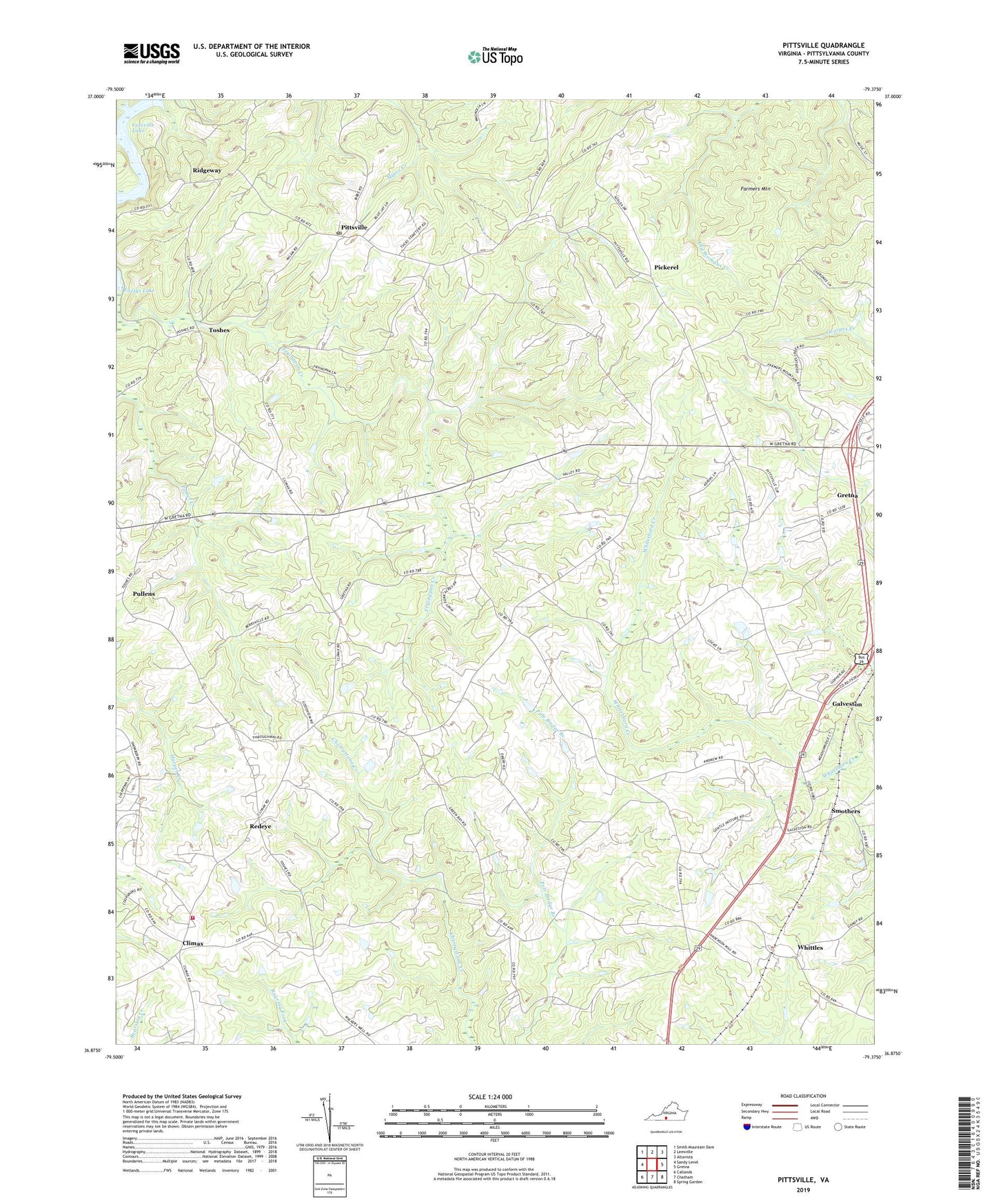
2022 topographic map quadrangle Pittsville in the state of Virginia. Scale: 1:24000. Based on the newly updated USGS 7.5' US Topo map series, this map is in the following counties: Pittsylvania. The map contains contour data, water features, and other items you are used to seeing on USGS maps, but also has updated roads and other features. This is the next generation of topographic maps. Printed on high-quality waterproof paper with UV fade-resistant inks.
Quads adjacent to this one:
West: Sandy Level
Northwest: Smith Mountain Dam
North: Leesville
Northeast: Altavista
East: Gretna
Southeast: Spring Garden
South: Chatham
Southwest: Callands
This map covers the same area as the classic USGS quad with code o36079h4.
Contains the following named places: Amos Store, Antioch Church, Antioch School, Bennett Mine, Burning Bush Church, Callands-Gretna District, Clifton School, Climax, Climax Elementary School, Climax Volunteer Fire Department, Davis School, Farmers, Farmers Mountain, Farmers School, Fuzzys Lake, Galveston, Green Bay Church, Kingwood School, Mount Vale School, Newton, Payneton Church, Pickerel, Pine Hill Church, Piney Fork Church, Piney Grove Church, Piney Grove School, Pittsville, Pittsville Post Office, Pullens, Ramsey School, Redeye, Ridgeway, Ridgeway Church, Shelhorse Dam, Shellhorse School, Siloam Church, Smothers, The Cedars Country Club, Thompsons Mine, Toshes, Union Church, Walkers Well, Watson Level Church, Whittles