MyTopo
Stephenson Virginia US Topo Map
Couldn't load pickup availability
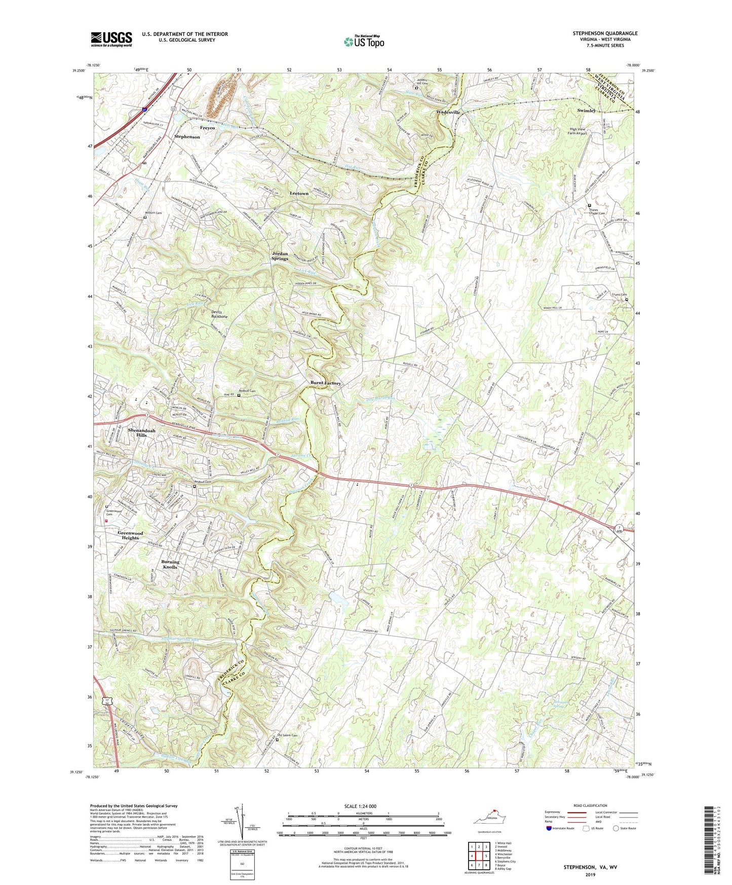
2022 topographic map quadrangle Stephenson in the state of Virginia. Scale: 1:24000. Based on the newly updated USGS 7.5' US Topo map series, this map is in the following counties: Clarke, Frederick, Jefferson. The map contains contour data, water features, and other items you are used to seeing on USGS maps, but also has updated roads and other features. This is the next generation of topographic maps. Printed on high-quality waterproof paper with UV fade-resistant inks.
Quads adjacent to this one:
West: Winchester
Northwest: White Hall
North: Inwood
Northeast: Middleway
East: Berryville
Southeast: Ashby Gap
South: Boyce
Southwest: Stephens City
Contains the following named places: Abrams Creek, Abrams Creek School, Annefield Estate, Ash Hollow Run, Berryville Crossing, Blue Ridge Mobile Home Park, Brentwood Terrace, Buffalo Lick Run, Burning Knolls, Burnt Factory, Carpers Valley, Carpers Valley Church, Cather Estates, Clarke County Recreation Area, Clearbrook Run, Cleridge, Clevengers Ford, Country Park, Crums Cemetery, Crums Church, Devils Backbone, Dry Marsh Run, Edgewood School, Emmanuel Church, Frederick County Fire and Rescue Department Station 18 - Greenwood Volunteer Fire and Rescue, Freyco, Glendale School, Greenwood Cemetery, Greenwood Church, Greenwood Heights, Greenwood Mills, Hawthorne School, Helmsley Estate, Hiatt Run, High View Farm Airport, Holy Trinity Mission Seminary, Horsepen Spring, Hot Run, House of Jacob, Hout School, Isaac Run, Jabbers Hill Cemetery, Jonesville Estate, Jordan Springs, Keeneland, Keystone Christian Academy, Keystone Estates, Leetown, Leetown School, Lick Run, Milburn Cemetery, Milburn Chapel, Millbrook High School, Minnie Wood Chapel, Mount Pleasant, Mount Sinai Church, North End Estate, Old Salem Cemetery, Old Salem Church, Payne Mobile Home Park, Pines Corner School, Red Bud District, Red Bud School, Redbud Cemetery, Redbud Church, Redbud Run, Redbud Run Elementary School, Rock Hall, Rocky Ford, Russell District, Seivers Ford, Seventh Day Adventist School, Shenandoah Hills, Sheppard Dam, Sheppard Pond, Slate Run, Spring Meadows Trailer Park, Stephenson, Stephenson Post Office, Stones Chapel, Stones Chapel Cemetery, Stonewall District, Stonewall Elementary School, Sulfur Spring School, Sulphur Spring Ford, Sulphur Spring Run, Swimley, Tanquarys Ford, The Cottage Estate, Turkey Run, Valley Mill, Wadesville, Wamplers Trailer Park, ZIP Code: 22656