MyTopo
South Hill SE Virginia US Topo Map
Couldn't load pickup availability
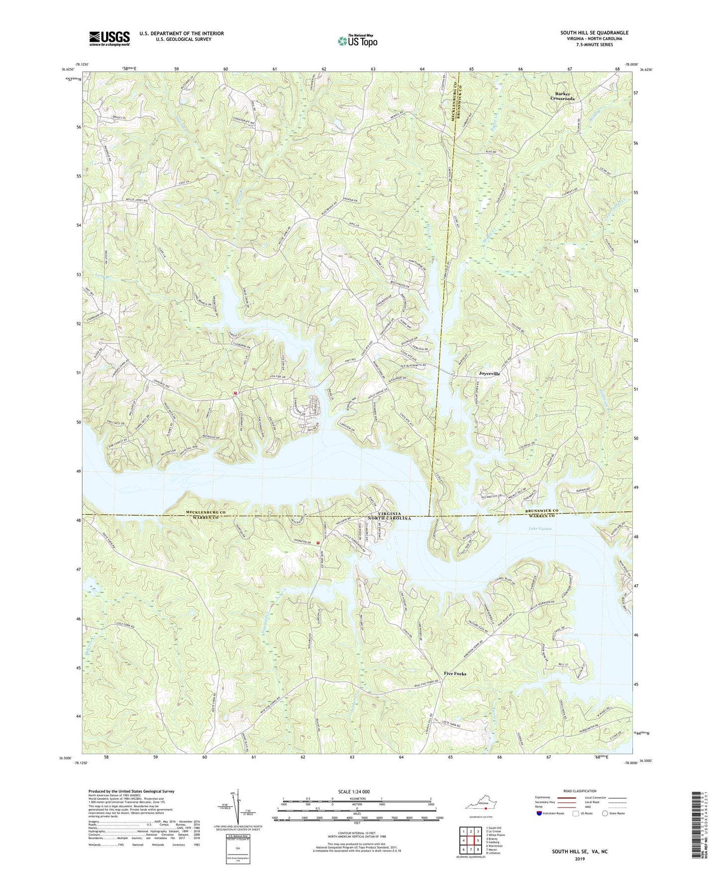
2022 topographic map quadrangle South Hill SE in the states of Virginia, North Carolina. Scale: 1:24000. Based on the newly updated USGS 7.5' US Topo map series, this map is in the following counties: Mecklenburg, Warren, Brunswick. The map contains contour data, water features, and other items you are used to seeing on USGS maps, but also has updated roads and other features. This is the next generation of topographic maps. Printed on high-quality waterproof paper with UV fade-resistant inks.
Quads adjacent to this one:
West: Bracey
Northwest: South Hill
North: La Crosse
Northeast: White Plains
East: Gasburg
Southeast: Littleton
South: Macon
Southwest: Warrenton
This map covers the same area as the classic USGS quad with code o36078e1.
Contains the following named places: Barker Crossroads, Bethel Grove Church, Boyds Island, Bracey Census Designated Place, Cedar Grove, Churchill Five Forks Volunteer Fire Department Substation, Ebony School, Five Forks, Good Hope Church, Good Hope School, Great Creek, Great Creek Church, Greenback, Hagood Creek, Hebron Church, Holly Grove Church, Jordan Creek, Jordan Hill Church, Joyceville, Lake Gaston, Lake Gaston Volunteer Fire Department Company 8, Little Poplar Creek, Long Branch, Lyons Creek, Middle Creek, Miles Creek, Moodys Ferry, Nocarva Airport, Pleasant Hill Church, Poplar Creek, Rehobeth Church, Rehoboth Church, Saint Stephens Church, Saint Stevens School, Siouan Scout Reservation, Sixpound Creek, Stillhouse Branch