MyTopo
Gasburg Virginia US Topo Map
Couldn't load pickup availability
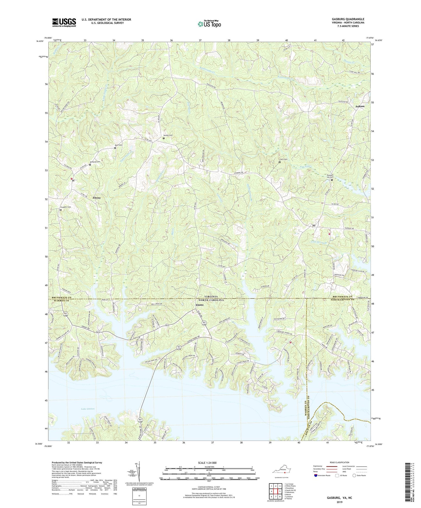
2022 topographic map quadrangle Gasburg in the states of Virginia, North Carolina. Scale: 1:24000. Based on the newly updated USGS 7.5' US Topo map series, this map is in the following counties: Brunswick, Warren, Northampton, Halifax. The map contains contour data, water features, and other items you are used to seeing on USGS maps, but also has updated roads and other features. This is the next generation of topographic maps. Printed on high-quality waterproof paper with UV fade-resistant inks.
Quads adjacent to this one:
West: South Hill SE
Northwest: La Crosse
North: White Plains
Northeast: Powellton
East: Valentines
Southeast: Thelma
South: Littleton
Southwest: Macon
This map covers the same area as the classic USGS quad with code o36077e8.
Contains the following named places: Ankum, Antioch Church, Clary Cemetery, Ebony, Ebony Census Designated Place, Ebony Post Office, Ebony Volunteer Fire Department, Elams, Gasburg, Gasburg Post Office, Gasburg Volunteer Fire Department, Hardy Spring Branch, Hubquarter Creek, Kirkland Cemetery, Lizard Creek, Mill Creek, Oak Corner, Pigeonroost Creek, Pleasant Hill Cemetery, Pleasant Hill Church, Powell Cemetery, Prospect Cemetery, Prospect Church, Reid Cemetery, Roanoke - Wildwood Volunteer Fire Department, Roanoke Chapel, Saint Pauls Chapel, Songbird Creek, Tillans Chapel, Township of Roanoke, ZIP Codes: 23845, 23857