MyTopo
Willis Virginia US Topo Map
Couldn't load pickup availability
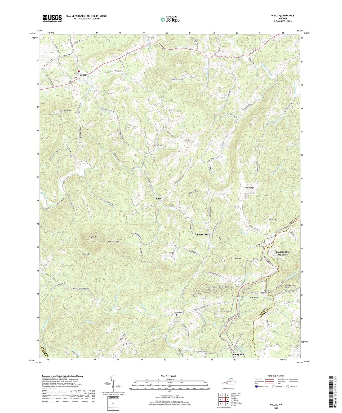
2019 topographic map quadrangle Willis in the state of Virginia. Scale: 1:24000. Based on the newly updated USGS 7.5' US Topo map series, this map is in the following counties: Floyd, Patrick, Carroll. The map contains contour data, water features, and other items you are used to seeing on USGS maps, but also has updated roads and other features. This is the next generation of topographic maps. Printed on high-quality waterproof paper with UV fade-resistant inks.
Quads adjacent to this one:
West: Dugspur
Northwest: Indian Valley
North: Alum Ridge
Northeast: Floyd
East: Woolwine
Southeast: Stuart
South: Meadows of Dan
Southwest: Laurel Fork
Contains the following named places: Black Ridge, Blue Ridge Church, Buffalo Branch, Buffalo Mountain, Buffalo Ridge, Burks Fork Church, Burks Fork District, Conners Grove, Conners Grove Baptist Church, East Prong Furnace Creek, Floyd County Volunteer Fire Department 2, Furnace Creek, Green Mountain Church, Harris Chapel, Hog Mountain, Indian Ridge, Jones Mountain, Long Mountain, Long Mountain Creek, Mabry Mill, Mabry Mill Pond, Mabry Mill Pond Dam, Oldfield Creek, Parkway Church, Reeds Creek, Rock Castle Gap, Rush Fork, Saint Mark Lutheran Church, Shelor Cemetery, Skyline Church, Slate Mountain, Slate Mountain Church, Topeco Church, Union, Union Church, West Prong Furnace Creek, Willis, Willis Elementary School, Willis Post Office, Willis United Methodist Church