MyTopo
Wylliesburg Virginia US Topo Map
Couldn't load pickup availability
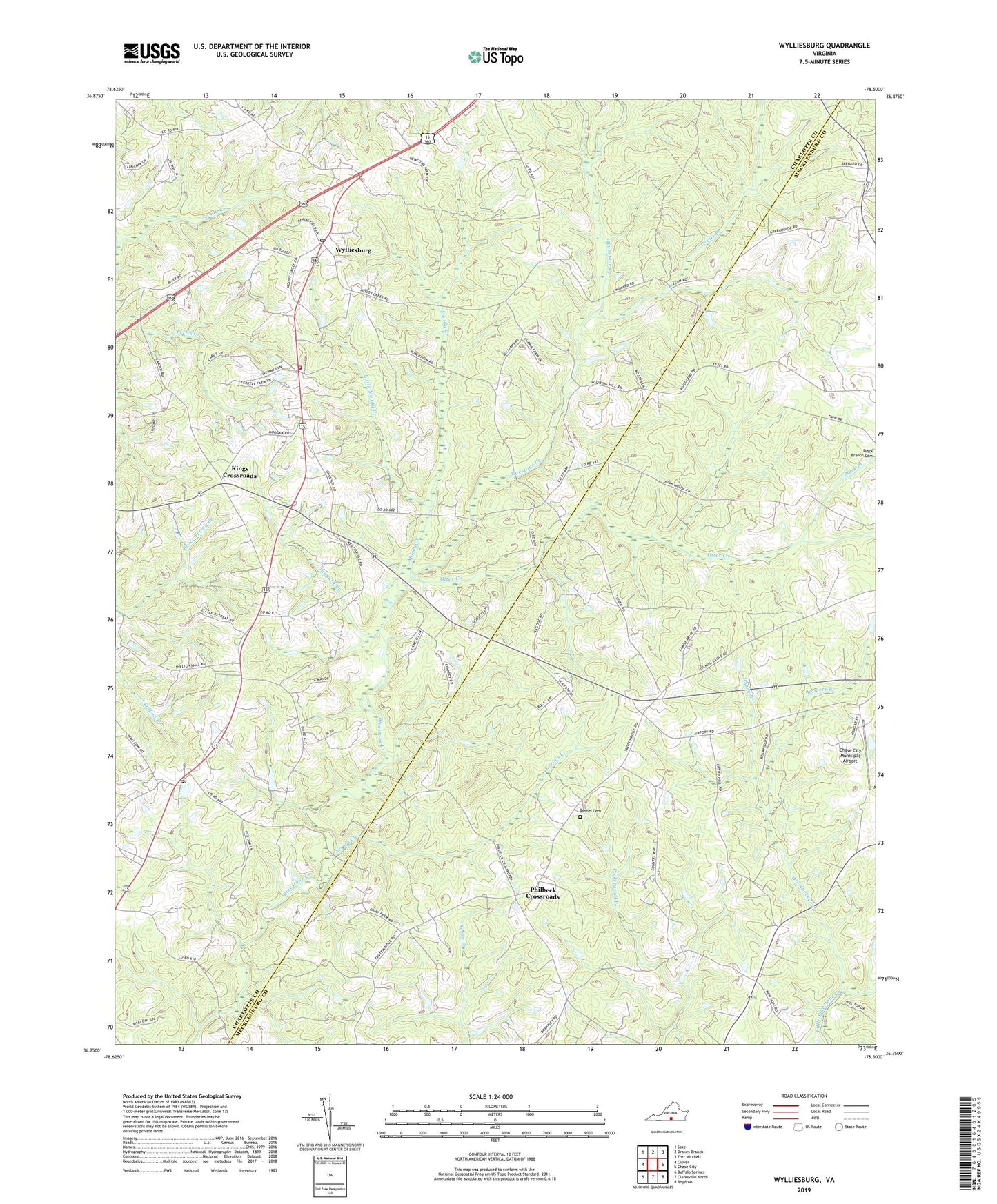
2019 topographic map quadrangle Wylliesburg in the state of Virginia. Scale: 1:24000. Based on the newly updated USGS 7.5' US Topo map series, this map is in the following counties: Charlotte, Mecklenburg. The map contains contour data, water features, and other items you are used to seeing on USGS maps, but also has updated roads and other features. This is the next generation of topographic maps. Printed on high-quality waterproof paper with UV fade-resistant inks.
Quads adjacent to this one:
West: Clover
Northwest: Saxe
North: Drakes Branch
Northeast: Fort Mitchell
East: Chase City
Southeast: Boydton
South: Clarksville North
Southwest: Buffalo Springs
Contains the following named places: Antioch Baptist Church, Apostolic Church of Jesus Christ, Bacon District, Bacon District Volunteer Fire Department, Barnes Junction, Bethel Baptist Church, Bethel Cemetery, Black Branch, Bluestone Baptist Church, Brewers Branch, Charlotte County Volunteer Rescue Squad Station 2 Wylliesburg, Chase City Municipal Airport, Church of Jesus Christ of Latter Day Saints, Devils Branch, Evdaileys Store, First Baptist Church, Hazen Branch, Hebron United Methodist Church, Kings Crossroads, Little Moody Creek, Moody Creek, Oak School, Otter Creek, Philbeck Crossroads, Red Oak, Red Oak Post Office, Spanish Grove, Tanyard Branch, The Lighthouse Church, Woodpecker Creek, Wylliesburg, Wylliesburg Baptist Church, Wylliesburg Post Office, Wylliesburg Presbyterian Church, Yerbys Creek, ZIP Code: 23976