MyTopo
Abercrombie Mountain Washington US Topo Map
Couldn't load pickup availability
Also explore the Abercrombie Mountain Forest Service Topo of this same quad for updated USFS data
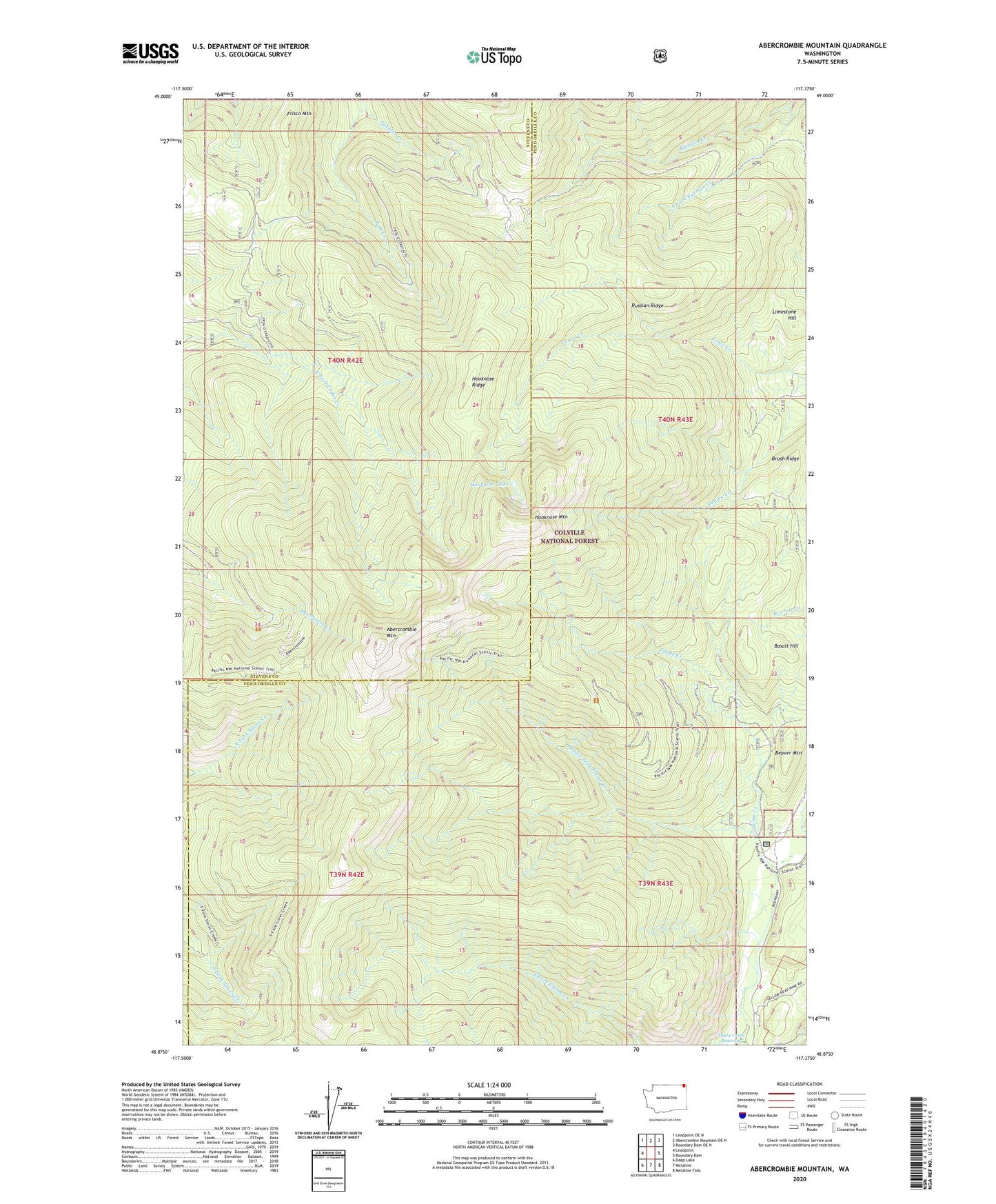
2023 topographic map quadrangle Abercrombie Mountain in the state of Washington. Scale: 1:24000. Based on the newly updated USGS 7.5' US Topo map series, this map is in the following counties: Pend Oreille, Stevens. The map contains contour data, water features, and other items you are used to seeing on USGS maps, but also has updated roads and other features. This is the next generation of topographic maps. Printed on high-quality waterproof paper with UV fade-resistant inks.
Quads adjacent to this one:
West: Leadpoint
Northwest: Leadpoint OE N
North: Abercrombie Mountain OE N
Northeast: Boundary Dam OE N
East: Boundary Dam
Southeast: Metaline Falls
South: Metaline
Southwest: Deep Lake
This map covers the same area as the classic USGS quad with code o48117h4.
Contains the following named places: Abercrombie Mountain, Basalt Hill, Beaver Mountain, Brush Ridge, Frisco Mountain, Gold Hill Mine, Hooknose Lake, Hooknose Mountain, Hooknose Ridge, Limestone Hill, Middle Fork Flume Creek, Russian Ridge, South Fork Russian Creek