MyTopo
Alger Washington US Topo Map
Couldn't load pickup availability
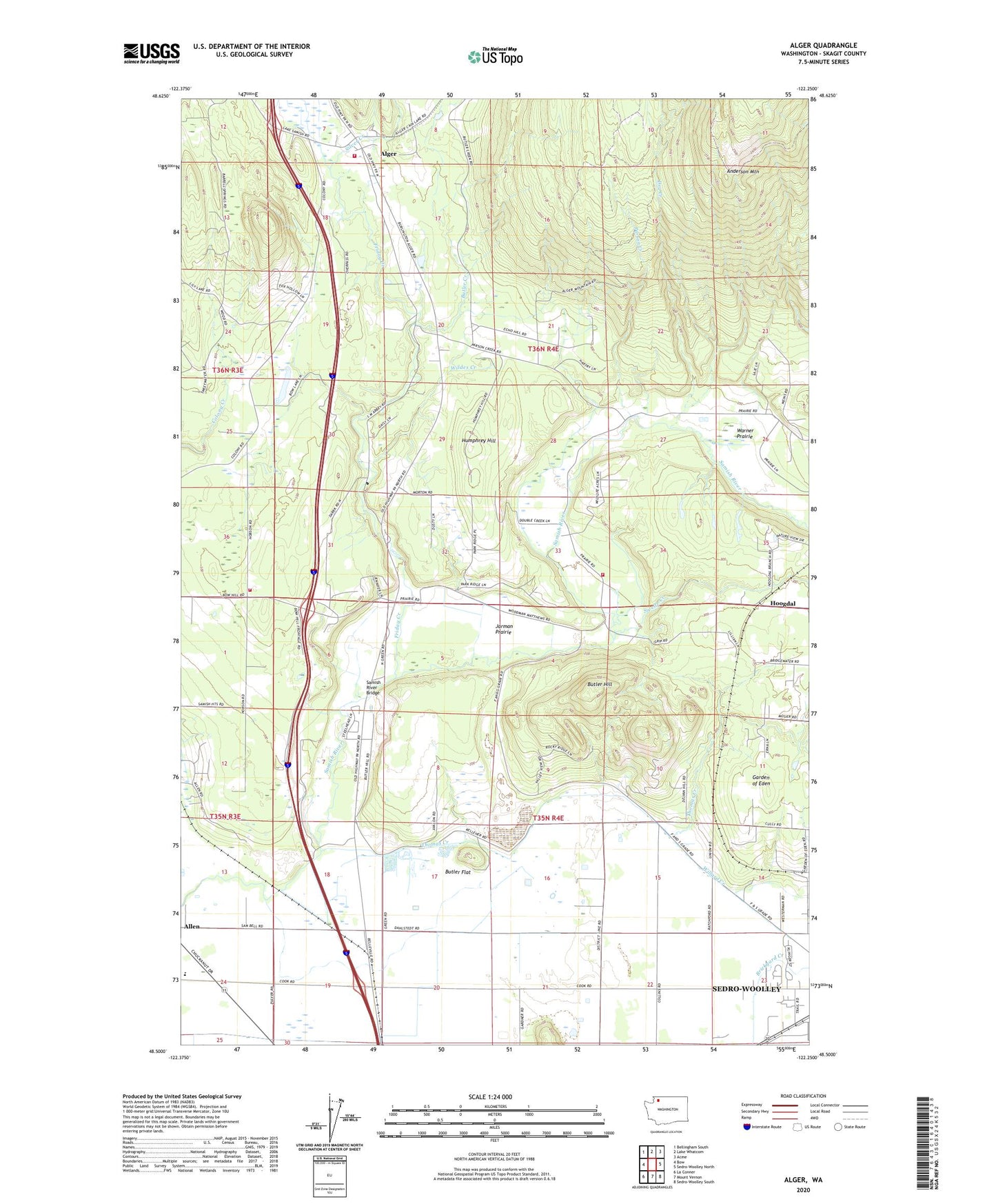
2023 topographic map quadrangle Alger in the state of Washington. Scale: 1:24000. Based on the newly updated USGS 7.5' US Topo map series, this map is in the following counties: Skagit. The map contains contour data, water features, and other items you are used to seeing on USGS maps, but also has updated roads and other features. This is the next generation of topographic maps. Printed on high-quality waterproof paper with UV fade-resistant inks.
Quads adjacent to this one:
West: Bow
Northwest: Bellingham South
North: Lake Whatcom
Northeast: Acme
East: Sedro-Woolley North
Southeast: Sedro-Woolley South
South: Mount Vernon
Southwest: La Conner
This map covers the same area as the classic USGS quad with code o48122e3.
Contains the following named places: Alger, Alger Census Designated Place, Alger Christian Reformed Church, Allen Elementary School, Anderson Mountain, Avalon Golf Club, Belfast, Belfast Gravel Quarry, Belfast School, Belleville, Belleville Quarry, Brickyard Creek, Butler Creek, Butler Flat, Butler Hill, Butler North Quarry, Butler Pit, Butler Quarry, Cook Road Park and Ride, Dans Dairy, De Boer Dairy, Donovan State Park, Dry Creek, Friday Creek, Garden of Eden, Hickson Community Hall, Hoogdal, Humphrey Hill, Jarman Prairie, Parson Creek, Samish Hatchery, Samish River Bridge, Samish River Quarry, Sedro - Woolley School District 101 Office, Silver Creek, Silver Run Grange, Skagit County Fire District 14 Alger Fire Department, Skagit County Fire District 8 Hickson, Skagit Quarry, Skagit Speedway, Swede Creek, Thomas Creek, Two Bobs Dairy, Upper Skagit Reservation, Warner Prairie, Wildes Creek, Willard Creek, ZIP Code: 98233