MyTopo
Acme Washington US Topo Map
Couldn't load pickup availability
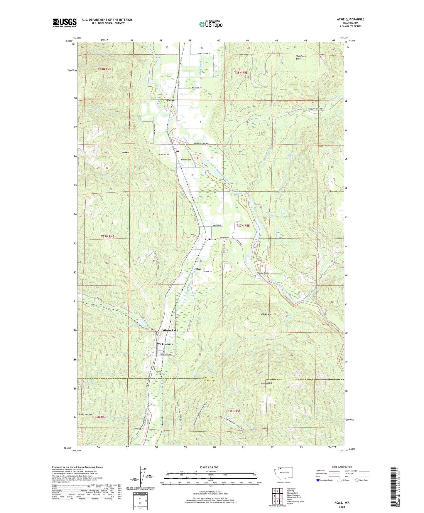
2023 topographic map quadrangle Acme in the state of Washington. Scale: 1:24000. Based on the newly updated USGS 7.5' US Topo map series, this map is in the following counties: Whatcom, Skagit. The map contains contour data, water features, and other items you are used to seeing on USGS maps, but also has updated roads and other features. This is the next generation of topographic maps. Printed on high-quality waterproof paper with UV fade-resistant inks.
Quads adjacent to this one:
West: Lake Whatcom
Northwest: Lawrence
North: Deming
Northeast: Canyon Lake
East: Cavanaugh Creek
Southeast: Lyman
South: Sedro-Woolley North
Southwest: Alger
This map covers the same area as the classic USGS quad with code o48122f2.
Contains the following named places: Acme, Acme Census Designated Place, Acme Elementary School, Acme Field, Acme Post Office, Acme Presbyterian Church, Anderson Dairy, Blue Mountain, Christie Creek, Coldstream Farm, Comar, Doolittle Creek, Doran, Duck Pond, Eddys Mountain, Edfro Creek, Ennis Creek, Ferguson Ponds, Hutchinson Creek, Jones Creek, Kalsbeek Dairy, Lonesome Pond, Lummi Indian Business Council Skookum Creek Fish Hatchery, Marona Mill Pond, Marona Mill Pond Dam, McCarty Creek, Mirror Lake, Mirror Lake Siding, Pond Creek, Saxon, Saxon Bridge, Saxon Cemetery, Saxon Quarry, Shetler Dairy, Skookum Creek, Standard Creek, Whatcom County Fire District 16, Wickersham, ZIP Code: 98220