MyTopo
Yacolt Washington US Topo Map
Couldn't load pickup availability
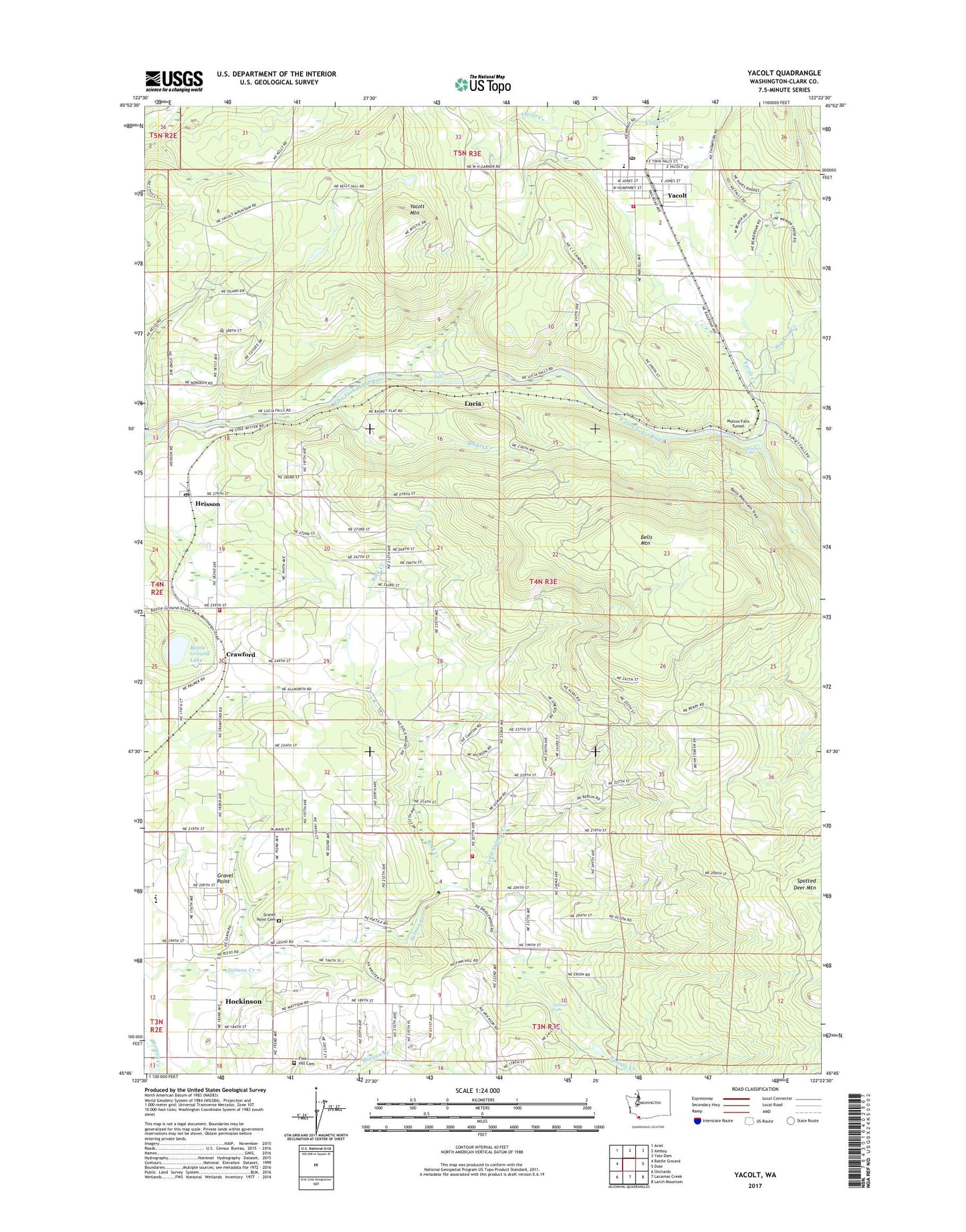
2023 topographic map quadrangle Yacolt in the state of Washington. Scale: 1:24000. Based on the newly updated USGS 7.5' US Topo map series, this map is in the following counties: Clark. The map contains contour data, water features, and other items you are used to seeing on USGS maps, but also has updated roads and other features. This is the next generation of topographic maps. Printed on high-quality waterproof paper with UV fade-resistant inks.
Quads adjacent to this one:
West: Battle Ground
Northwest: Ariel
North: Amboy
Northeast: Yale Dam
East: Dole
Southeast: Larch Mountain
South: Lacamas Creek
Southwest: Orchards
This map covers the same area as the classic USGS quad with code o45122g4.
Contains the following named places: Alpine, Basket Creek, Battle Ground Division, Battle Ground Lake, Battle Ground State Park, Bells Mountain, Big Tree Creek, Clark County, Clark County Fire District 3 Station 32, Clark County Fire District 3 Station 33, Crawford, Finn Hill Cemetery, Gravel Point, Gravel Point Cemetery, Heisson, Heisson Post Office, Homola Dam, Little Salmon Creek, Lucia, Lucia Falls, Moulton, Moulton Falls, Moulton Falls Park, Multon Falls Tunnel, North Country Emergency Medical Services Station 1, Rock Creek, Roosevelt Elementary School, Salmon Falls, Spotted Deer Mountain, Town of Yacolt, Venersborg, Venersborg Census Designated Place, Yacolt, Yacolt Creek, Yacolt Fire Department, Yacolt Mountain, Yacolt Post Office, Yacolt Primary School