MyTopo
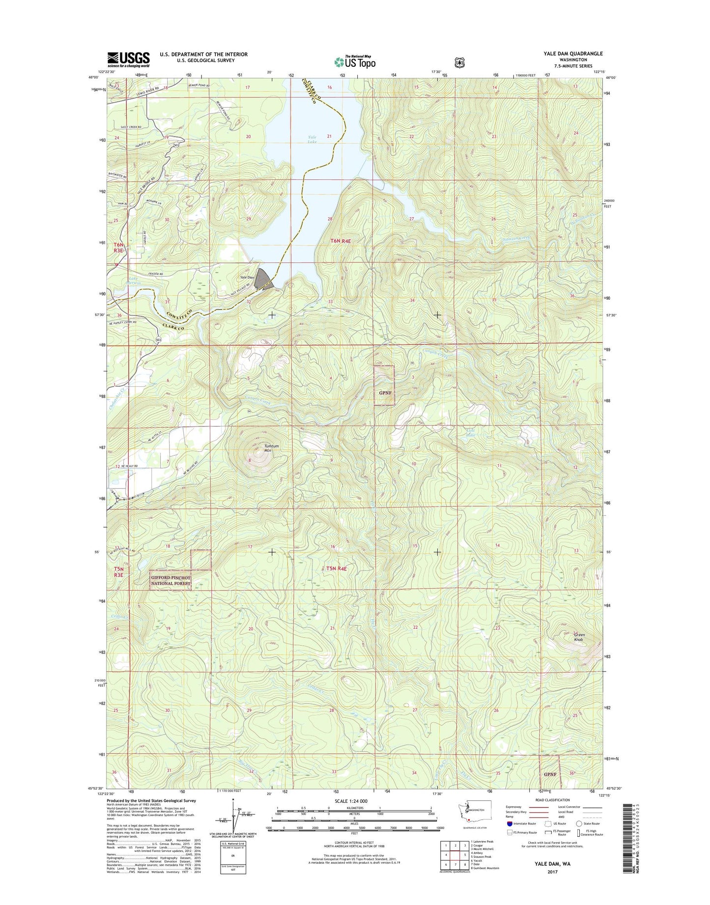
Yale Dam Washington US Topo Map
Couldn't load pickup availability
Also explore the Yale Dam Forest Service Topo of this same quad for updated USFS data
2023 topographic map quadrangle Yale Dam in the state of Washington. Scale: 1:24000. Based on the newly updated USGS 7.5' US Topo map series, this map is in the following counties: Clark, Cowlitz. The map contains contour data, water features, and other items you are used to seeing on USGS maps, but also has updated roads and other features. This is the next generation of topographic maps. Printed on high-quality waterproof paper with UV fade-resistant inks.
Quads adjacent to this one:
West: Amboy
Northwest: Lakeview Peak
North: Cougar
Northeast: Mount Mitchell
East: Siouxon Peak
Southeast: Gumboot Mountain
South: Dole
Southwest: Yacolt
This map covers the same area as the classic USGS quad with code o45122h3.
Contains the following named places: Canyon Creek, Chelatchie Prarie Mill Pond, Chelatchie Prarie Mill Pond Dam, Cowlitz - Skamania Fire District 7 Station 74, Fly Creek, Green Knob, Little Fly Creek, Lost Lake, North Country Emergency Medical Services Cresap Bay Station, North Siouxon Creek, Saddle Dam, Saddle Dam Campground, Siouxon Creek, Speelyai Hill Viewpoint, Tumtum Mountain, Yacolt Division, Yale Dam, ZIP Code: 98601