MyTopo
Destruction Island Washington US Topo Map
Couldn't load pickup availability
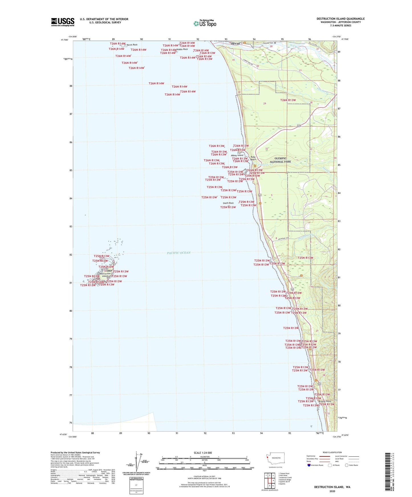
2023 topographic map quadrangle Destruction Island in the state of Washington. Scale: 1:24000. Based on the newly updated USGS 7.5' US Topo map series, this map is in the following counties: Jefferson. The map contains contour data, water features, and other items you are used to seeing on USGS maps, but also has updated roads and other features. This is the next generation of topographic maps. Printed on high-quality waterproof paper with UV fade-resistant inks.
Quads adjacent to this one:
Northwest: Toleak Point
North: Hoh Head
Northeast: Anderson Creek
East: Kalaloch Ridge
Southeast: Queets
South: Queets OE W
This map covers the same area as the classic USGS quad with code o47124f4.
Contains the following named places: Abbey Island, Beach Trail 5, Beach Trail 6, Beach Trail 7, Browns Point, Cedar Creek, Destruction Island, Destruction Island Lighthouse, Destruction Island Viewpoint, Fletcher Cemetery, Fletcher Creek, Fossil Creek, Hoh, Hoh Indian Reservation, Hoh River, Middle Rock, North Rock, Ruby Beach, Sand Creek, South Rock, Steamboat Creek