MyTopo
Bearpaw Mountain Washington US Topo Map
Couldn't load pickup availability
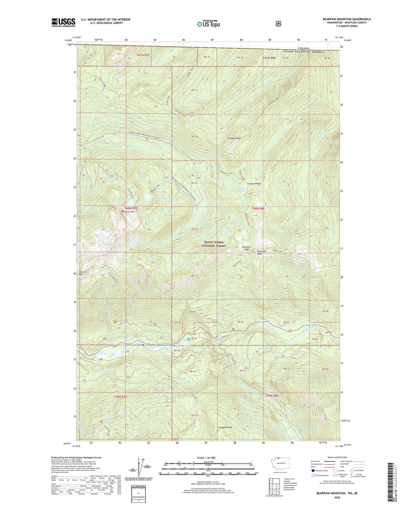
2020 topographic map quadrangle Bearpaw Mountain in the state of Washington. Scale: 1:24000. Based on the newly updated USGS 7.5' US Topo map series, this map is in the following counties: Whatcom. The map contains contour data, water features, and other items you are used to seeing on USGS maps, but also has updated roads and other features. This is the next generation of topographic maps. Printed on high-quality waterproof paper with UV fade-resistant inks.
Quads adjacent to this one:
West: Glacier
Northwest: Glacier OE N
East: Mount Larrabee
Southeast: Shuksan Arm
South: Mount Baker
Southwest: Groat Mountain
Contains the following named places: Bearpaw Mountain, Bearpaw Mountain Lake, Bee Creek, Boyd Creek, Bridge Camp, Canyon Lake, Canyon Ridge, Cascade Creek, Church Lake, Consolidation Creek, Cowap Peak, Damfino Lakes, Dead Horse Creek, Deer Horn Creek, Excelsior Campground, Excelsior Lookout, Excelsior Mine, Excelsior Pass, Excelsior Peak, Fossil Creek, Nooksack Campground, Nooksack Diversion Dam, Nooksack Falls, Nooksack Falls Viewpoint, Nooksack Power Plant, North Fork Nooksack Research Natural Area, Pinus Lake, Wells Creek, Whistler Lake