MyTopo
Mount Larrabee Washington US Topo Map
Couldn't load pickup availability
Also explore the Mount Larrabee Forest Service Topo of this same quad for updated USFS data
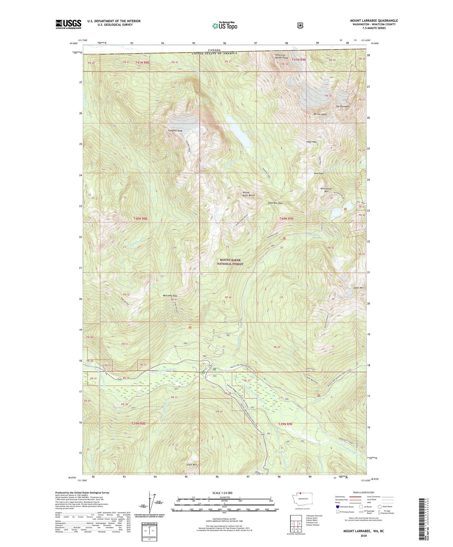
2023 topographic map quadrangle Mount Larrabee in the state of Washington. Scale: 1:24000. Based on the newly updated USGS 7.5' US Topo map series, this map is in the following counties: Whatcom. The map contains contour data, water features, and other items you are used to seeing on USGS maps, but also has updated roads and other features. This is the next generation of topographic maps. Printed on high-quality waterproof paper with UV fade-resistant inks.
Quads adjacent to this one:
West: Bearpaw Mountain
East: Mount Sefrit
Southeast: Mount Shuksan
South: Shuksan Arm
Southwest: Mount Baker
This map covers the same area as the classic USGS quad with code o48121h6.
Contains the following named places: American Border Peak, Anderson Creek, Bagley Creek, Barometer Creek, Galena Creek, Gargett Mine, Goat Mountain, Goat Mountain Lookout, Gold Run Pass, High Pass, Low Pass, Mount Larrabee, Quartz Creek, Razor Hone Creek, Red Mountain Mine, Ruth Creek, Shuksan, Shuksan Campground, Silver Fir Campground, Silvertip Mine, Skagway Pass, Swamp Creek, The Pleiades, Tomyhoi Lake, Tomyhoi Peak, Twin Lakes, Welcome Pass, White Salmon Creek, Winchester Mountain, Winchester Mountain Lookout, Yellow Aster Butte