MyTopo
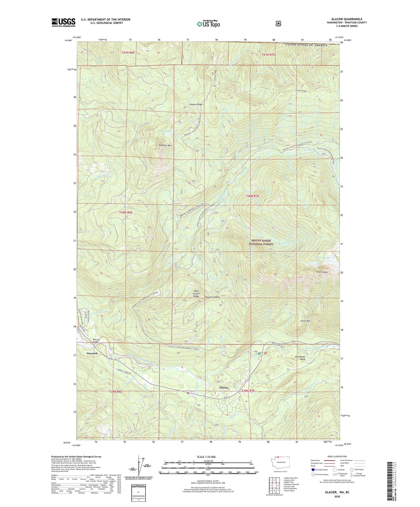
Glacier Washington US Topo Map
Couldn't load pickup availability
Also explore the Glacier Forest Service Topo of this same quad for updated USFS data
2023 topographic map quadrangle Glacier in the state of Washington. Scale: 1:24000. Based on the newly updated USGS 7.5' US Topo map series, this map is in the following counties: Whatcom. The map contains contour data, water features, and other items you are used to seeing on USGS maps, but also has updated roads and other features. This is the next generation of topographic maps. Printed on high-quality waterproof paper with UV fade-resistant inks.
Quads adjacent to this one:
West: Maple Falls
Northwest: Maple Falls OE N
North: Glacier OE N
East: Bearpaw Mountain
Southeast: Mount Baker
South: Groat Mountain
Southwest: Canyon Lake
This map covers the same area as the classic USGS quad with code o48121h8.
Contains the following named places: Bald Lake, Canyon Creek, Canyon Creek Campground, Church Mountain, Church Saddle, Clean Creek, Coal Creek, Cornell Creek, Davis Creek, Dippy Creek, Douglas Fir Campground, Gallop Creek, Glacier, Glacier Census Designated Place, Glacier Chamber of Commerce, Glacier Creek, Glacier Public Service Center, Hedrick Creek, Horseshoe Bend, Hurst Creek, Jim Creek, Kaisoots Mountain, Kidney Creek, Kidney Lakes, Little Creek, Little Mountain, Lookout Creek, Maple Creek, Mount Baker-Snoqualmie National Forest, Thompson Creek, Warnick, Warnick Bridge, West Church Ridge, West Cornell Creek, Whatcom County Fire District 19 Glacier Fire and Rescue, Whistler Creek