MyTopo
Shuksan Arm Washington US Topo Map
Couldn't load pickup availability
Also explore the Shuksan Arm Forest Service Topo of this same quad for updated USFS data
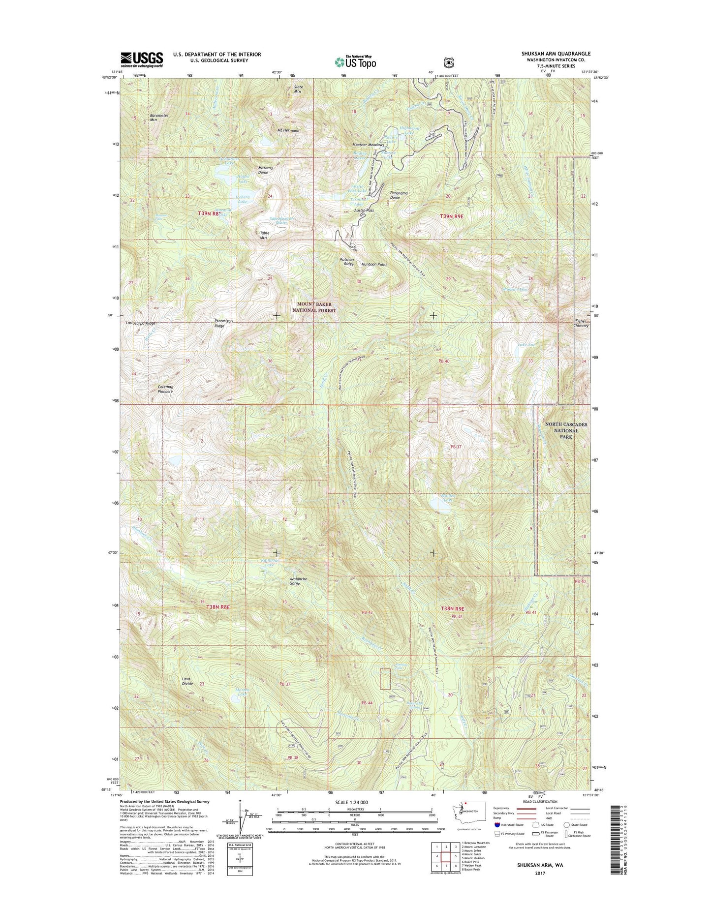
2023 topographic map quadrangle Shuksan Arm in the state of Washington. Scale: 1:24000. Based on the newly updated USGS 7.5' US Topo map series, this map is in the following counties: Whatcom. The map contains contour data, water features, and other items you are used to seeing on USGS maps, but also has updated roads and other features. This is the next generation of topographic maps. Printed on high-quality waterproof paper with UV fade-resistant inks.
Quads adjacent to this one:
West: Mount Baker
Northwest: Bearpaw Mountain
North: Mount Larrabee
Northeast: Mount Sefrit
East: Mount Shuksan
Southeast: Bacon Peak
South: Welker Peak
Southwest: Baker Pass
This map covers the same area as the classic USGS quad with code o48121g6.
Contains the following named places: Arbuthnet Lake, Austin Pass, Austin Pass Lake, Avalanche Gorge, Bagley Lakes, Baker Hot Spring, Barometer Mountain, Camp Kiser, Coleman Pinnacle, Fisher Chimney, Galena Camp, Galena Chain Lakes, Hayes Lake, Heather Meadows, Highwood Lake, Huntoon Point, Iceberg Lake, Kulshan Ridge, Lake Ann, Maiden Lake, Marten Lake, Mazama Dome, Mazama Falls, Mazama Lake, Mount Baker Lodge, Mount Baker Lodge Lakes, Mount Baker Post Office, Mount Baker Ski Resort, Mount Baker Wilderness, Mount Hermann, Panorama Dome, Picture Lake, Ptarmigan Ridge, Rainbow Creek, Rainbow Falls, Rainbow Lake, Shuksan Arm, Shuksan Creek, Slate Mountain, Sunrise Lake, Table Mountain, Table Mountain Glacier, Terminal Lake, Vista Viewpoint