MyTopo
Groat Mountain Washington US Topo Map
Couldn't load pickup availability
Also explore the Groat Mountain Forest Service Topo of this same quad for updated USFS data
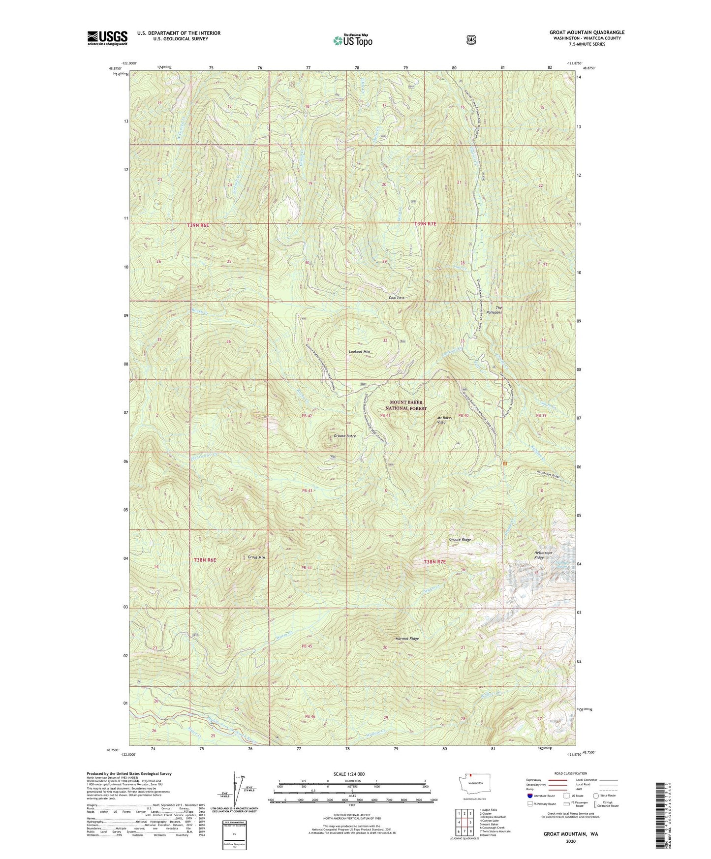
2023 topographic map quadrangle Groat Mountain in the state of Washington. Scale: 1:24000. Based on the newly updated USGS 7.5' US Topo map series, this map is in the following counties: Whatcom. The map contains contour data, water features, and other items you are used to seeing on USGS maps, but also has updated roads and other features. This is the next generation of topographic maps. Printed on high-quality waterproof paper with UV fade-resistant inks.
Quads adjacent to this one:
West: Canyon Lake
Northwest: Maple Falls
North: Glacier
Northeast: Bearpaw Mountain
East: Mount Baker
Southeast: Baker Pass
South: Twin Sisters Mountain
Southwest: Cavanaugh Creek
This map covers the same area as the classic USGS quad with code o48121g8.
Contains the following named places: Coal Creek, Coal Pass, Deep Creek, Falls Creek, Groat Mountain, Grouse Butte, Grouse Creek, Grouse Ridge, Heliotrope Creek, Kulshan Creek, Lookout Creek, Lookout Mountain, Marmot Ridge, Mount Baker Trailhead, Mount Baker Vista, Mount Baker Vista Picnic Area, Rocky Creek, Sister Creek, Smith Creek, The Gorge, The Palisades, Warm Creek, ZIP Code: 98244