MyTopo
Silver Falls Washington US Topo Map
Couldn't load pickup availability
Also explore the Silver Falls Forest Service Topo of this same quad for updated USFS data
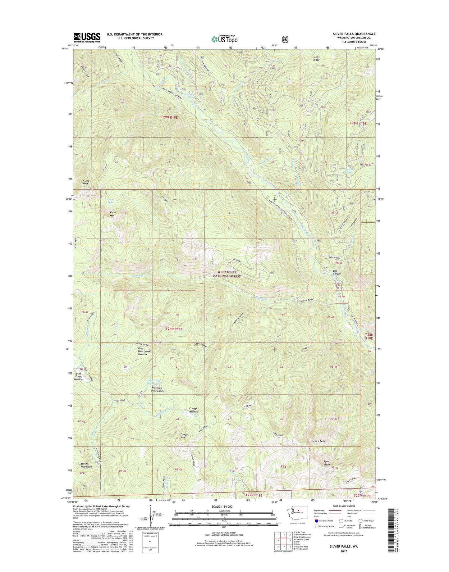
2023 topographic map quadrangle Silver Falls in the state of Washington. Scale: 1:24000. Based on the newly updated USGS 7.5' US Topo map series, this map is in the following counties: Chelan. The map contains contour data, water features, and other items you are used to seeing on USGS maps, but also has updated roads and other features. This is the next generation of topographic maps. Printed on high-quality waterproof paper with UV fade-resistant inks.
Quads adjacent to this one:
West: Chikamin Creek
Northwest: Saska Peak
North: Pyramid Mountain
Northeast: Big Goat Mountain
East: Brief
Southeast: Tyee Mountain
South: Sugarloaf Peak
Southwest: Plain
This map covers the same area as the classic USGS quad with code o47120h5.
Contains the following named places: Blue Creek, Blue Creek Campground, Blue Creek Forest Service Station, Blue Creek Meadow, Box Canyon, Cougar Meadow, Cougar Mountain, Cougar Mountain Lookout, Devil Lake, East Blue Creek Meadow, Entiat Falls, Fox Creek, Fox Creek Campground, Halfway Spring, Halfway Spring Campground, Hunters Trail, Hunters Trail Shelter, Jungle Creek, Kelly Mountain, Klone Peak, Lake Creek, Lake Creek Campground, North Fork Campground, North Fork Entiat River, Pope Creek, Signal Peak, Silver Creek, Silver Falls, Silver Falls Campground, Silver Falls Forest Service Station, Snowshoe Spring, Three Creek, Three Creek Ridge Camp, Tommy Creek, Tyee Ridge, Whistling Pig Creek, Whistling Pig Meadow, ZIP Code: 98822