MyTopo
Big Snow Mountain Washington US Topo Map
Couldn't load pickup availability
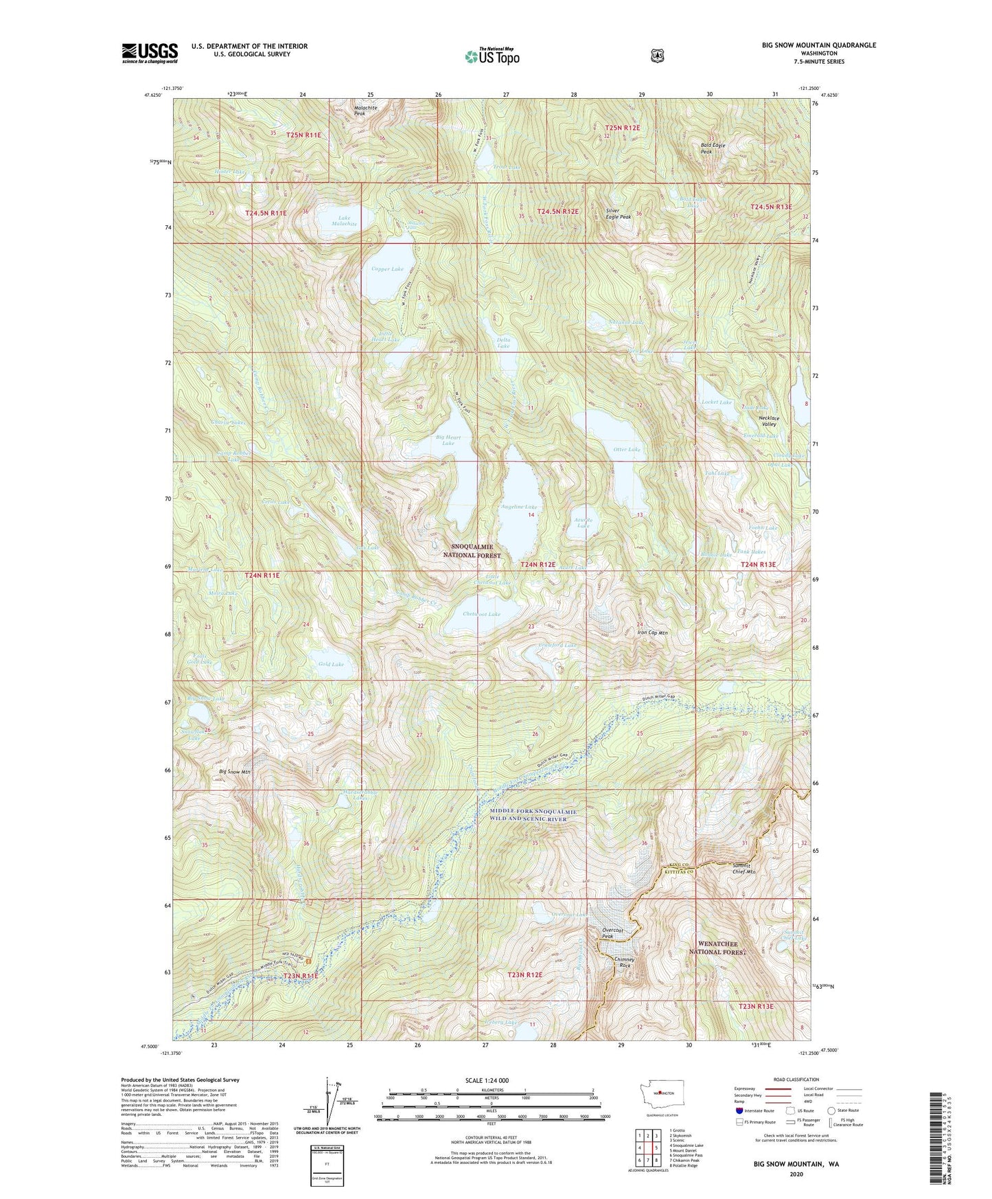
2020 topographic map quadrangle Big Snow Mountain in the state of Washington. Scale: 1:24000. Based on the newly updated USGS 7.5' US Topo map series, this map is in the following counties: King, Kittitas. The map contains contour data, water features, and other items you are used to seeing on USGS maps, but also has updated roads and other features. This is the next generation of topographic maps. Printed on high-quality waterproof paper with UV fade-resistant inks.
Quads adjacent to this one:
West: Snoqualmie Lake
Northwest: Grotto
North: Skykomish
Northeast: Scenic
East: Mount Daniel
Southeast: Polallie Ridge
South: Chikamin Peak
Southwest: Snoqualmie Pass
Contains the following named places: Angeline Lake, Azure Lake, Azurite Lake, Bald Eagle Lake, Bald Eagle Peak, Big Heart Lake, Big Snow Lake, Big Snow Mountain, Bonnie Lake, Camp Robber Lake, Camp Robber Valley, Cecils Lake, Charlie Lakes, Chetwoot Lake, Chimney Rock, Cloudy Lake, Copper Lake, Crawford Creek, Crawford Lake, Delta Lake, Emerald Lake, Foehn Lake, Fools Gold Lake, Gold Lake, Gus Lake, Hardscrabble Creek, Hardscrabble Lakes, Hinter Lake, Iceberg Lake, Iron Cap Mountain, Jade Lake, Jewel Lake, Lake Ilswoot, Lake Malachite, Little Chetwoot Lake, Little Heart Lake, Locket Lake, Malachite Falls, Malachite Peak, Marlene Lake, Moira Lake, Nazanne Lake, Necklace Valley, Necklace Valley Lakes, Opal Lake, Otter Lake, Overcoat Lake, Overcoat Peak, Silver Eagle Peak, Snowflake Lake, Summit Chief Lake, Summit Chief Mountain, Tahl Lake, Tank Lakes, Trout Lake, View Lake