MyTopo
Chikamin Peak Washington US Topo Map
Couldn't load pickup availability
Also explore the Chikamin Peak Forest Service Topo of this same quad for updated USFS data
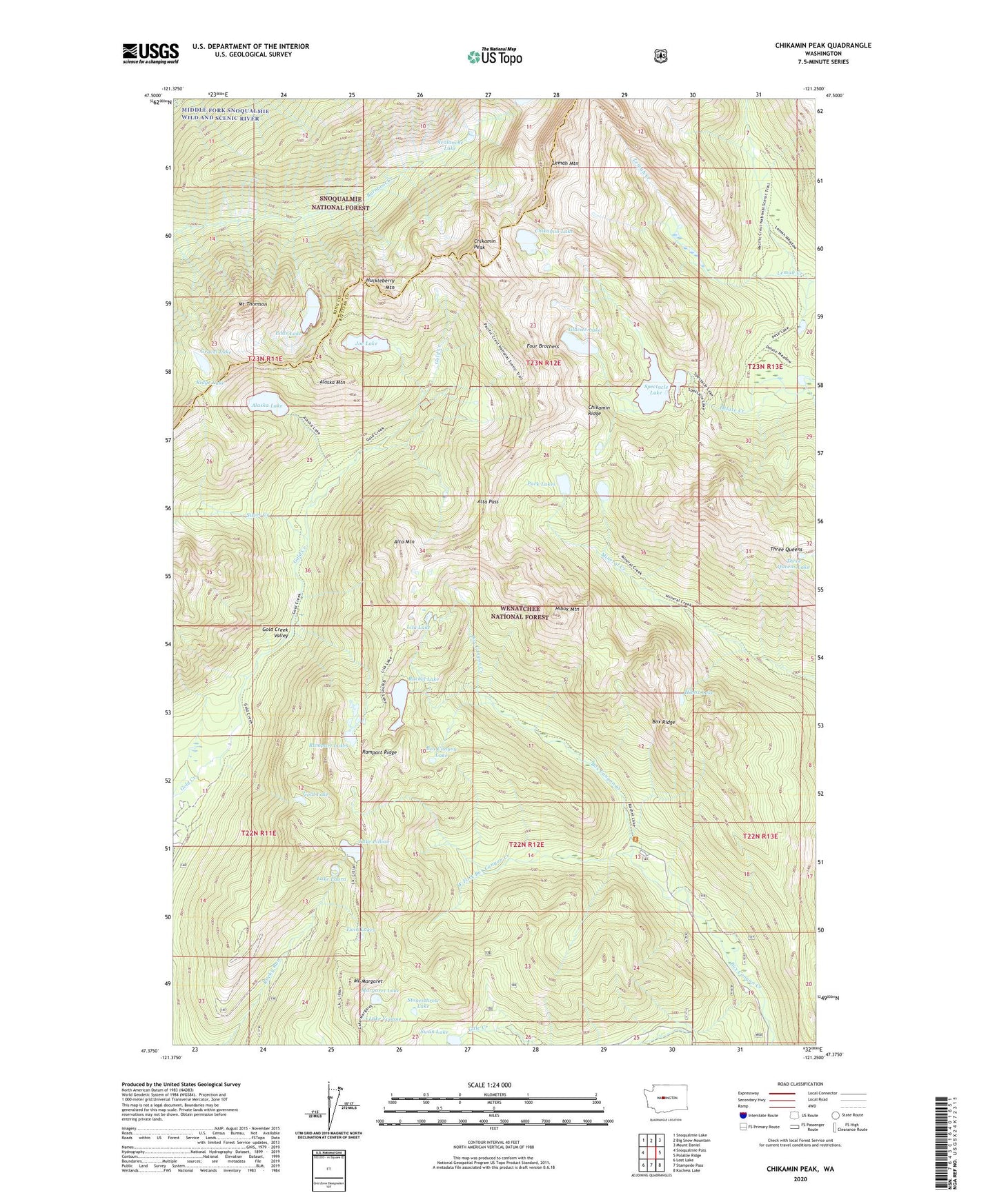
2023 topographic map quadrangle Chikamin Peak in the state of Washington. Scale: 1:24000. Based on the newly updated USGS 7.5' US Topo map series, this map is in the following counties: Kittitas, King. The map contains contour data, water features, and other items you are used to seeing on USGS maps, but also has updated roads and other features. This is the next generation of topographic maps. Printed on high-quality waterproof paper with UV fade-resistant inks.
Quads adjacent to this one:
West: Snoqualmie Pass
Northwest: Snoqualmie Lake
North: Big Snow Mountain
Northeast: Mount Daniel
East: Polallie Ridge
Southeast: Kachess Lake
South: Stampede Pass
Southwest: Lost Lake
This map covers the same area as the classic USGS quad with code o47121d3.
Contains the following named places: Alaska Lake, Alaska Mountain, Alta Mountain, Alta Pass, Avalanche Lake, Box Canyon Lake, Box Ridge, Chikamin Lake, Chikamin Peak, Chikamin Ridge, Edds Lake, Four Brothers, Glacier Lake, Gold Lake, Gravel Lake, Hibox Lake, Hibox Mountain, Huckleberry Mountain, Joe Lake, Lake Laura, Lake Lillian, Lake Yvonne, Lemah Mountain, Lila Lake, Margaret Lake, Mount Margaret, Mount Thomson, Park Lakes, Rachel Lake, Rampart Lakes, Rampart Ridge, Ridge Lake, Silver Creek, Spectacle Lake, Stonesthrow Lake, Swan Lake, Three Queens, Three Queens Lake, Twin Lakes, West Fork Box Canyon Creek, ZIP Code: 98068