MyTopo
Scenic Washington US Topo Map
Couldn't load pickup availability
Also explore the Scenic Forest Service Topo of this same quad for updated USFS data
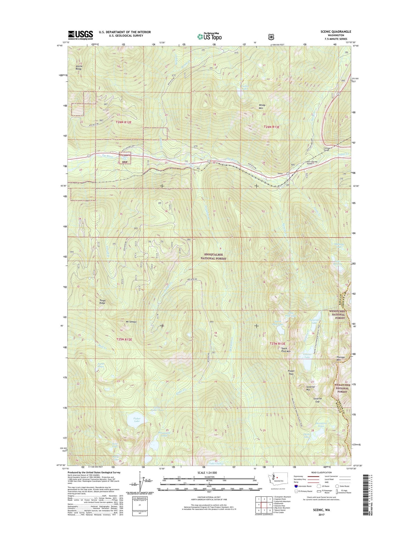
2023 topographic map quadrangle Scenic in the state of Washington. Scale: 1:24000. Based on the newly updated USGS 7.5' US Topo map series, this map is in the following counties: King, Chelan. The map contains contour data, water features, and other items you are used to seeing on USGS maps, but also has updated roads and other features. This is the next generation of topographic maps. Printed on high-quality waterproof paper with UV fade-resistant inks.
Quads adjacent to this one:
West: Skykomish
Northwest: Evergreen Mountain
North: Captain Point
Northeast: Labyrinth Mountain
East: Stevens Pass
Southeast: The Cradle
South: Mount Daniel
Southwest: Big Snow Mountain
This map covers the same area as the classic USGS quad with code o47121f2.
Contains the following named places: Alpine Baldy, Alpine Falls, Carroll Creek, Daisy Lake, Deception Creek, Deception Creek Campground, Deception Falls, Deception Falls Campground, Deception Falls Picnic Area, Deception Lakes, Embro Lake, Fisher Creek, Fisher Lake, Glacier Lake, Hamada Lake, Jewel Lakes, June Lake, Kelley Creek, Lake Murphy, Lake Sawyer, Little Plug Lake, Lower Fisher Lake, Martin Creek, Mary Lake, Mount Sawyer, Murphy Lakes, Pieper Pass, Ptarmigan Lake, Ptarmigan Lakes, Sawyer Creek, Scenic, Scenic Creek, Spark Plug Lake, Spark Plug Mountain, Surprise Creek, Surprise Gap, Surprise Lake, Surprise Mountain, Surprise Mountain Lookout, Thunder Mountain, Tonga Ridge, Tunnel Creek, Tye Canyon Campground, Windy Mountain