
MyTopo
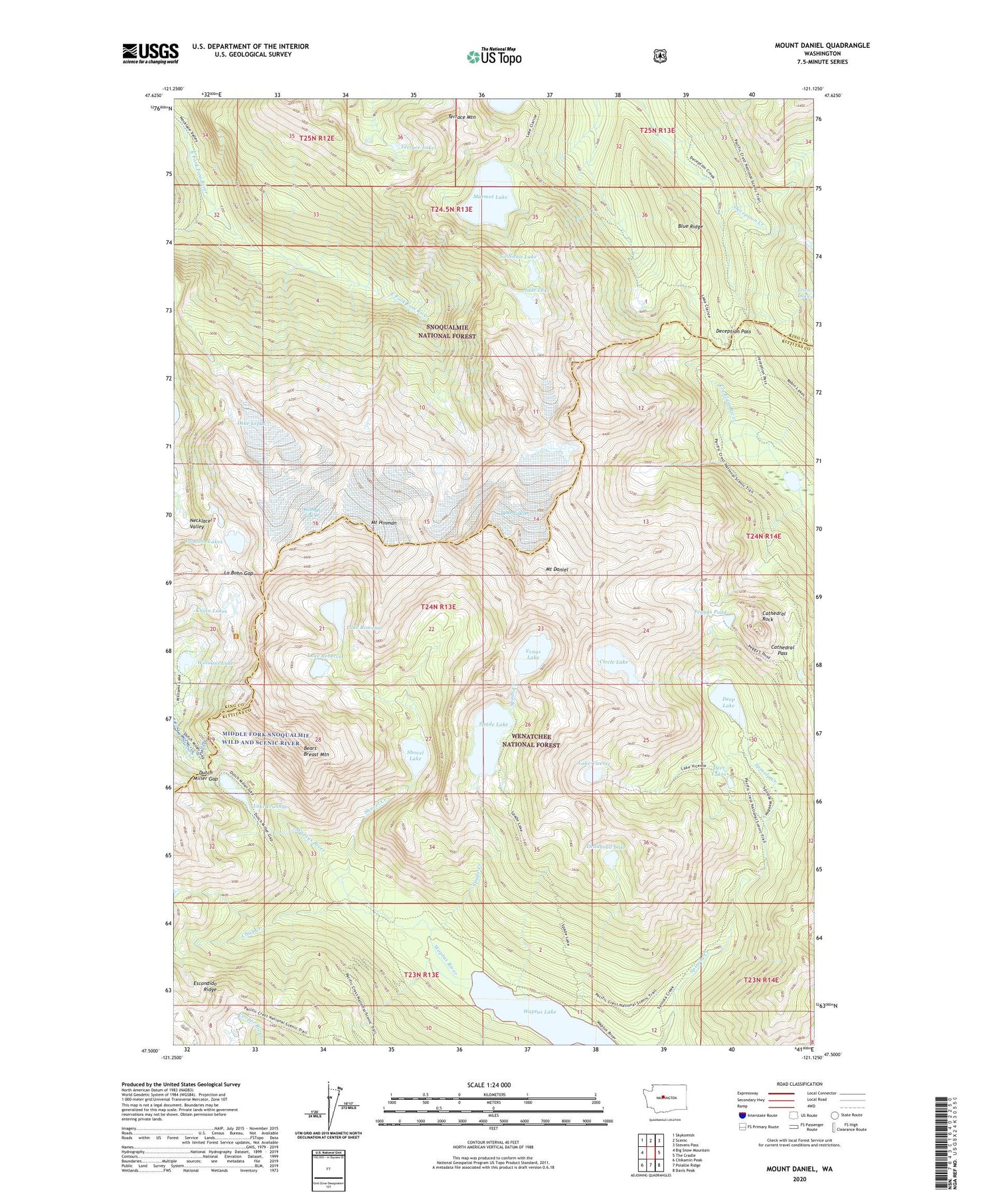
Mount Daniel Washington US Topo Map
Couldn't load pickup availability
Also explore the Mount Daniel Forest Service Topo of this same quad for updated USFS data
2023 topographic map quadrangle Mount Daniel in the state of Washington. Scale: 1:24000. Based on the newly updated USGS 7.5' US Topo map series, this map is in the following counties: Kittitas, King. The map contains contour data, water features, and other items you are used to seeing on USGS maps, but also has updated roads and other features. This is the next generation of topographic maps. Printed on high-quality waterproof paper with UV fade-resistant inks.
Quads adjacent to this one:
West: Big Snow Mountain
Northwest: Skykomish
North: Scenic
Northeast: Stevens Pass
East: The Cradle
Southeast: Davis Peak
South: Polallie Ridge
Southwest: Chikamin Peak
This map covers the same area as the classic USGS quad with code o47121e2.
Contains the following named places: Alpine Lakes Wilderness, Bears Breast Mountain, Blue Ridge, Cathedral Pass, Cathedral Rock, Chain Lakes, Chief Creek, Circle Lake, Deadhead Lake, Deception Pass, Deep Lake, Deer Lakes, Dutch Miller Gap, Escondido Ridge, Hinman Glacier, Hyas Lake, Jade Lake, La Bohn Gap, La Bohn Lakes, Lake Clarice, Lake Ivanhoe, Lake Lepul, Lake Rebecca, Lake Rowena, Lake Vicente, Lynch Glacier, Marmot Lake, Mount Daniel, Mount Hinman, No Name Lake, Peggys Pond, Shovel Creek, Shovel Lake, Spade Creek, Spade Lake, Terrace Lakes, Terrace Mountain, Venus Lake, Waptus Lake, Williams Lake


