MyTopo
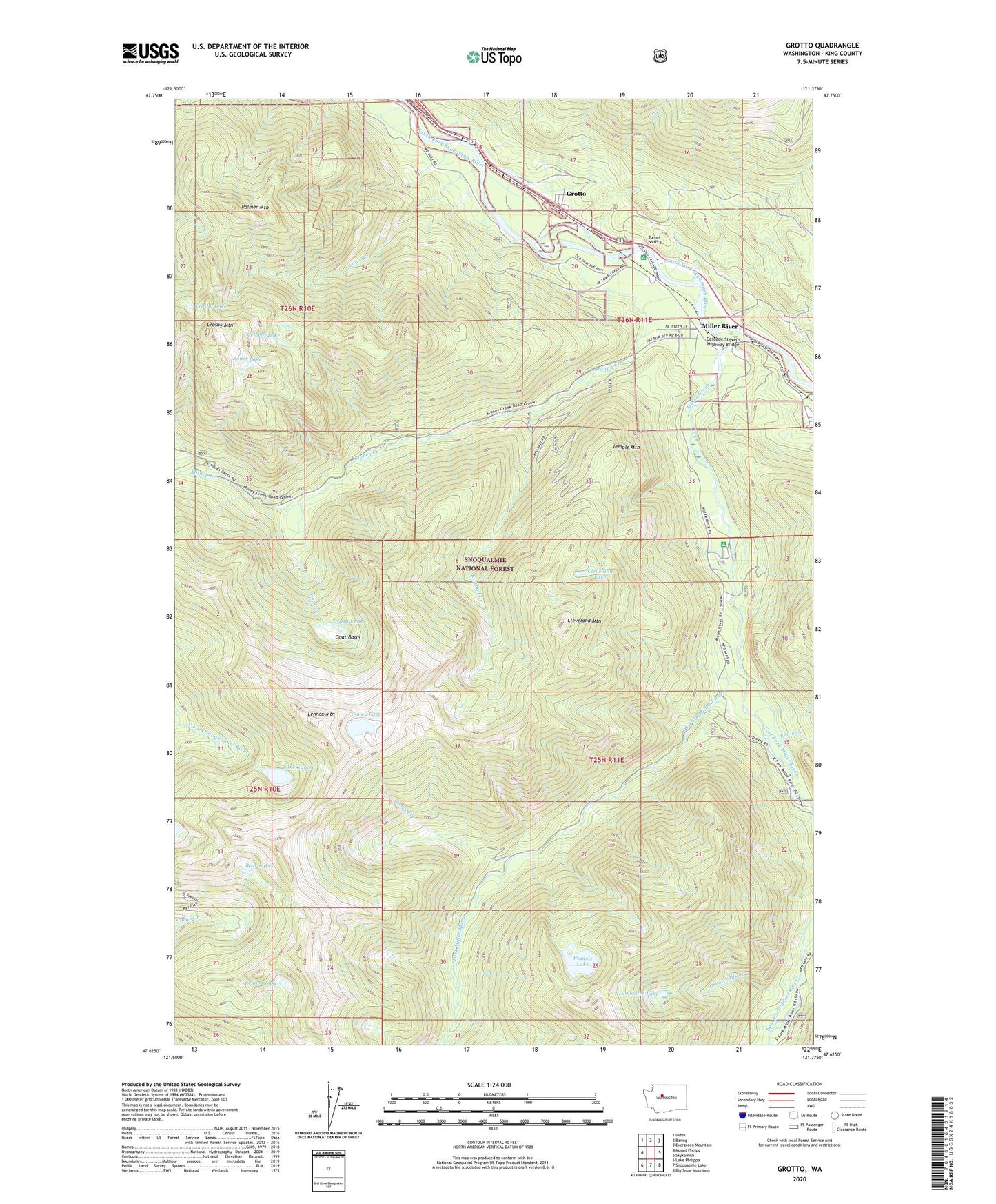
Grotto Washington US Topo Map
Couldn't load pickup availability
Also explore the Grotto Forest Service Topo of this same quad for updated USFS data
2023 topographic map quadrangle Grotto in the state of Washington. Scale: 1:24000. Based on the newly updated USGS 7.5' US Topo map series, this map is in the following counties: King. The map contains contour data, water features, and other items you are used to seeing on USGS maps, but also has updated roads and other features. This is the next generation of topographic maps. Printed on high-quality waterproof paper with UV fade-resistant inks.
Quads adjacent to this one:
West: Mount Phelps
Northwest: Index
North: Baring
Northeast: Evergreen Mountain
East: Skykomish
Southeast: Big Snow Mountain
South: Snoqualmie Lake
Southwest: Lake Philippa
This map covers the same area as the classic USGS quad with code o47121f4.
Contains the following named places: Bear Lakes, Boner Lake, Cascade Stevens Highway Bridge, Cement Lake, Cleopatra Mine, Cleveland Lake, Cleveland Mountain, Coney Creek, Coney Lake, Crosby Lake, Crosby Mountain, Crystal Lake, East Fork Miller River, Engle Creek, Francis Lake, Goat Basin, Goat Creek, Great Falls Creek, Grotto, Kimball Creek, Lake Kanim, Lennox Lake, Lennox Mountain, Lowe Creek, Miller River, Miller River Campground, Money Creek, Money Creek Campground, Palmer Mountain, Temple Mountain, Tumwater Lake, Tunnel on US 2, West Fork Campground, West Fork Miller River