MyTopo
Birch Point Washington US Topo Map
Couldn't load pickup availability
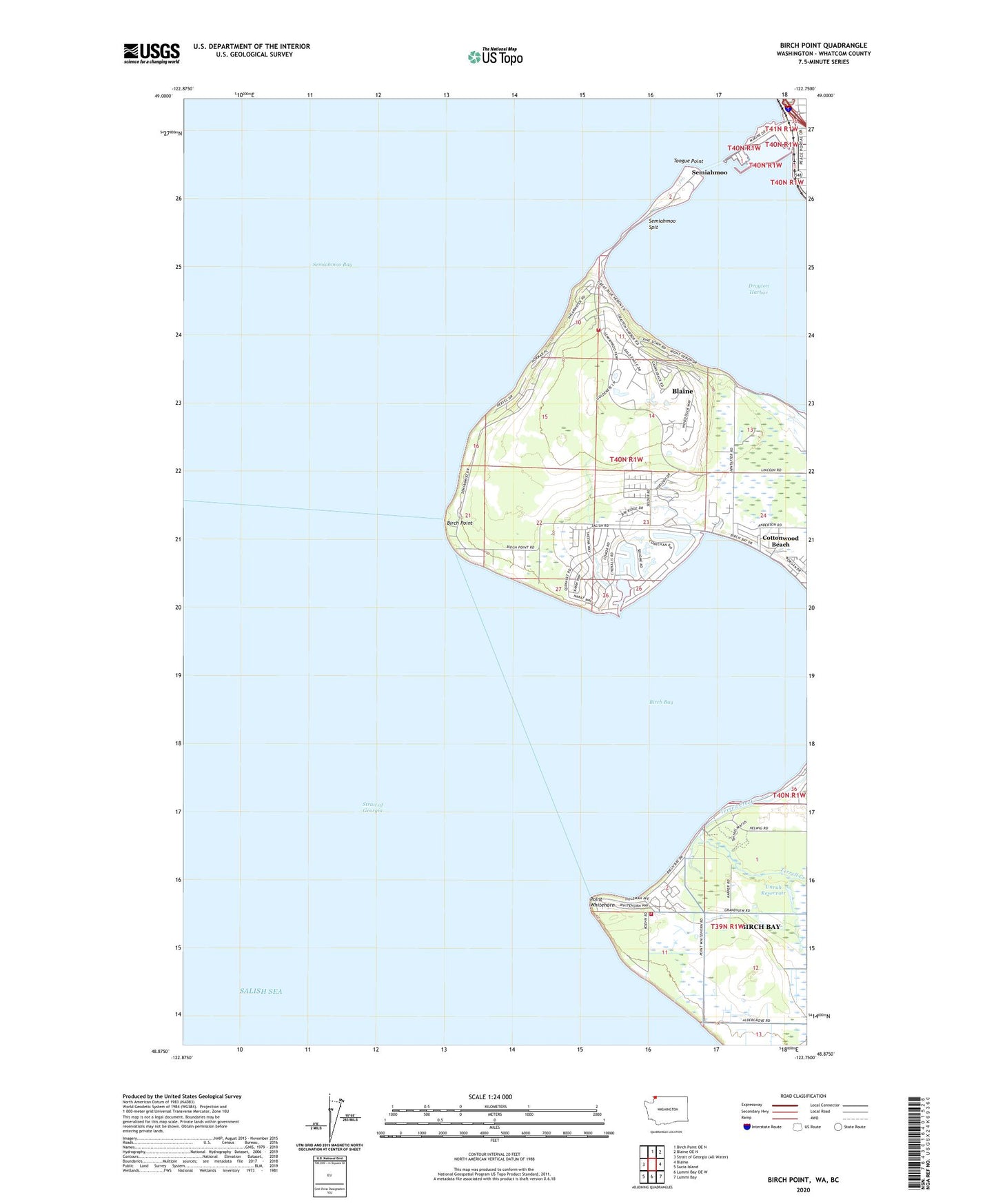
2023 topographic map quadrangle Birch Point in the state of Washington. Scale: 1:24000. Based on the newly updated USGS 7.5' US Topo map series, this map is in the following counties: Whatcom. The map contains contour data, water features, and other items you are used to seeing on USGS maps, but also has updated roads and other features. This is the next generation of topographic maps. Printed on high-quality waterproof paper with UV fade-resistant inks.
Quads adjacent to this one:
North: Birch Point OE N
Northeast: Blaine OE N
East: Blaine
Southeast: Lummi Bay
South: Lummi Bay OE W
Southwest: Sucia Island
This map covers the same area as the classic USGS quad with code o48122h7.
Contains the following named places: Birch Bay, Birch Bay Census Designated Place, Birch Bay Sewage Treatment Plant, Birch Bay State Park, Birch Bay Village Golf Course, Birch Bay Village Marina, Birch Point, Blaine Division, Blaine Visitors Center, Blaine Wastewater Treatment Plant, Cottonwood Beach, Drayton Harbor, North Bay Mobile Home Park, North Whatcom Fire Rescue Station 62 Semiahmoo, Point Whitehorn, Port of Blaine, Semiahmoo, Semiahmoo Bay, Semiahmoo Golf and Country Club, Semiahmoo Marina, Semiahmoo Park Maritime Museum, Semiahmoo Spit, Semiahmoo Yacht Club, Terrell Creek, Tongue Point, Unruh Reservoir, Unruh Reservoir Dam, Whatcom County Fire District 7 Station 44 - Birch Bay