
MyTopo
Boyds Washington US Topo Map
Couldn't load pickup availability
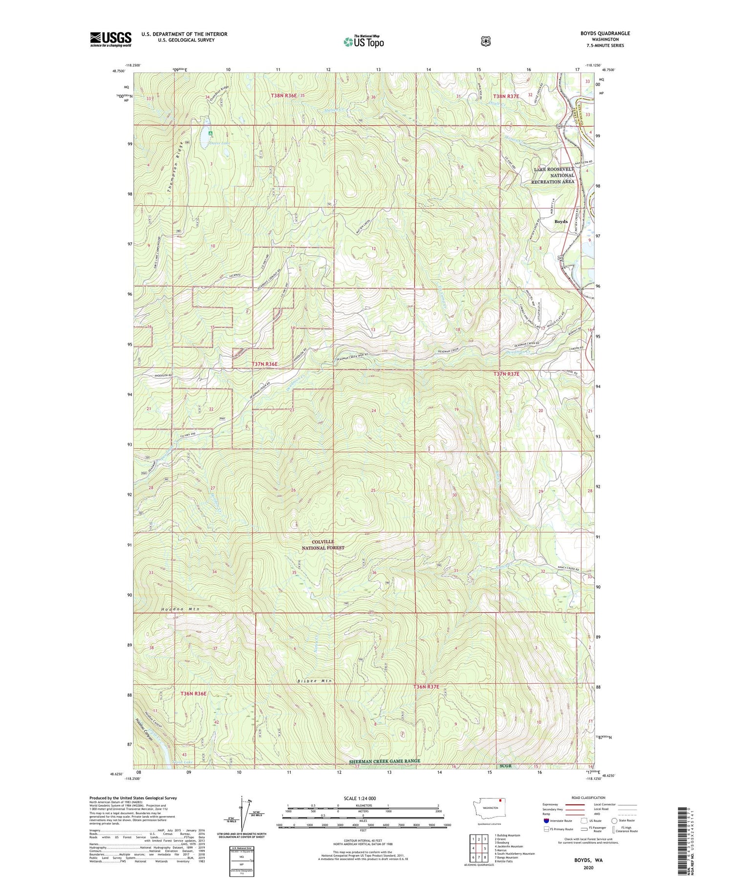
2020 topographic map quadrangle Boyds in the state of Washington. Scale: 1:24000. Based on the newly updated USGS 7.5' US Topo map series, this map is in the following counties: Ferry, Stevens. The map contains contour data, water features, and other items you are used to seeing on USGS maps, but also has updated roads and other features. This is the next generation of topographic maps. Printed on high-quality waterproof paper with UV fade-resistant inks.
Quads adjacent to this one:
West: Jackknife Mountain
Northwest: Bulldog Mountain
North: Orient
Northeast: Bossburg
East: Marcus
Southeast: Kettle Falls
South: Bangs Mountain
Southwest: South Huckleberry Mountain
Contains the following named places: Bisbee Mountain, Boyds, Boyds Census Designated Place, Davis Lake, Davis Lake Campground, Hoodoo Mountain, Matsen Creek, North Fork Deadman Creek, Thompson Ridge, Tie Camp Creek, Trout Lake, ZIP Code: 99141


