MyTopo
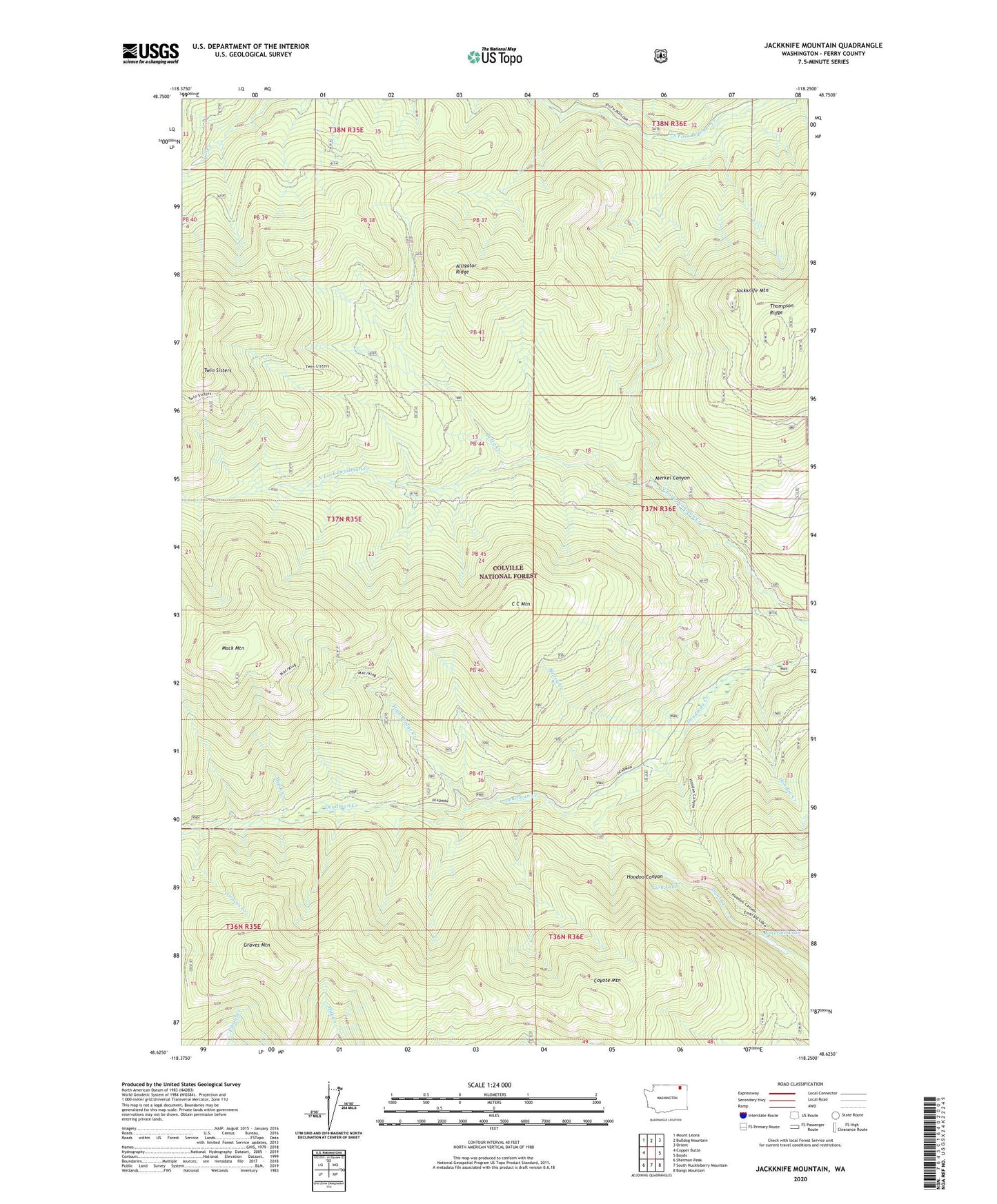
Jackknife Mountain Washington US Topo Map
Couldn't load pickup availability
Also explore the Jackknife Mountain Forest Service Topo of this same quad for updated USFS data
2023 topographic map quadrangle Jackknife Mountain in the state of Washington. Scale: 1:24000. Based on the newly updated USGS 7.5' US Topo map series, this map is in the following counties: Ferry. The map contains contour data, water features, and other items you are used to seeing on USGS maps, but also has updated roads and other features. This is the next generation of topographic maps. Printed on high-quality waterproof paper with UV fade-resistant inks.
Quads adjacent to this one:
West: Copper Butte
Northwest: Mount Leona
North: Bulldog Mountain
Northeast: Orient
East: Boyds
Southeast: Bangs Mountain
South: South Huckleberry Mountain
Southwest: Sherman Peak
This map covers the same area as the classic USGS quad with code o48118f3.
Contains the following named places: Alligator Ridge, Bailey Creek, Betty Creek, C C Mountain, Coyote Mountain, East Ferry Division, Emerald Lake, Graves Creek, Graves Mountain, High Bridge Creek, Hoodoo Canyon, Hoodoo Creek, Jackknife Mountain, Jackknife Mountain Lookout, Lilly Lake, M J B Creek, Mack Mountain, Merkel Canyon, Twin Sisters, Wash Creek