MyTopo
Boyer Mountain Washington US Topo Map
Couldn't load pickup availability
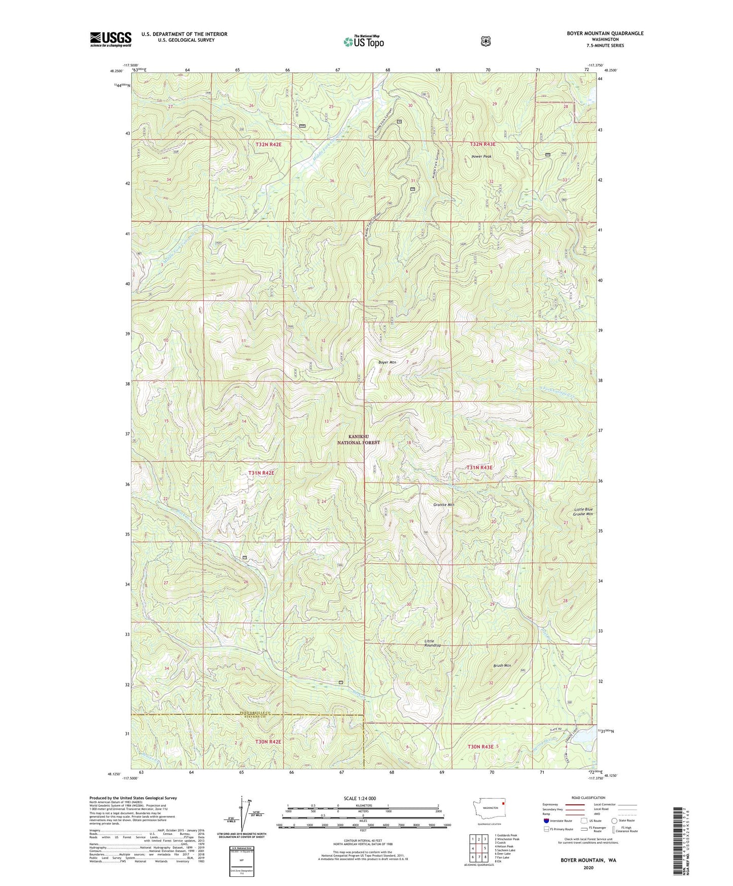
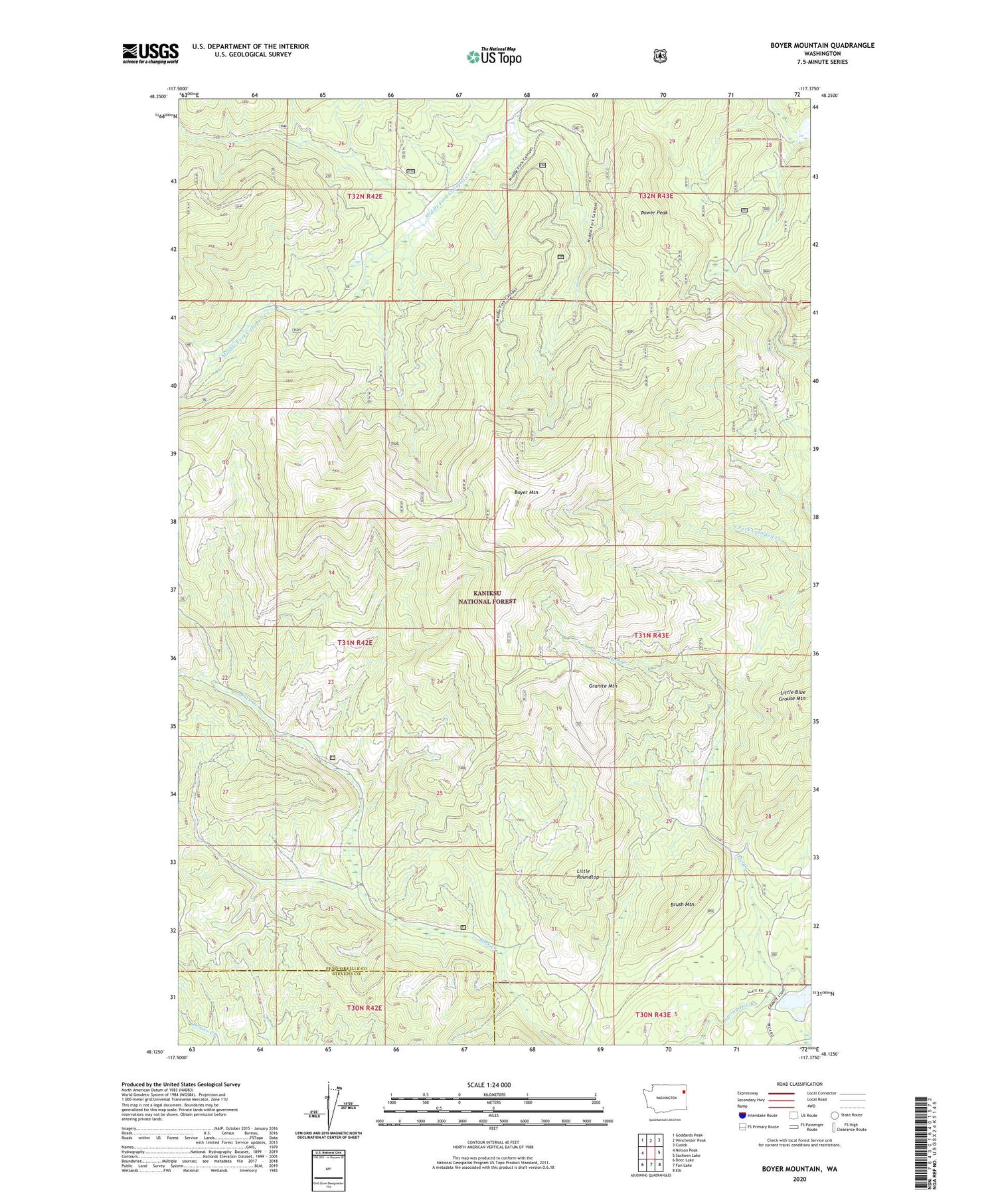
2020 topographic map quadrangle Boyer Mountain in the state of Washington. Scale: 1:24000. Based on the newly updated USGS 7.5' US Topo map series, this map is in the following counties: Pend Oreille, Stevens. The map contains contour data, water features, and other items you are used to seeing on USGS maps, but also has updated roads and other features. This is the next generation of topographic maps. Printed on high-quality waterproof paper with UV fade-resistant inks.
Quads adjacent to this one:
West: Nelson Peak
Northwest: Goddards Peak
North: Winchester Peak
Northeast: Cusick
East: Sacheen Lake
Southeast: Elk
South: Fan Lake
Southwest: Deer Lake
Contains the following named places: Boyer Mountain, Brush Mountain, Granite Mountain, Heel Creek, Kettwig Wildlife Dam, Little Roundtop, Power Peak