MyTopo
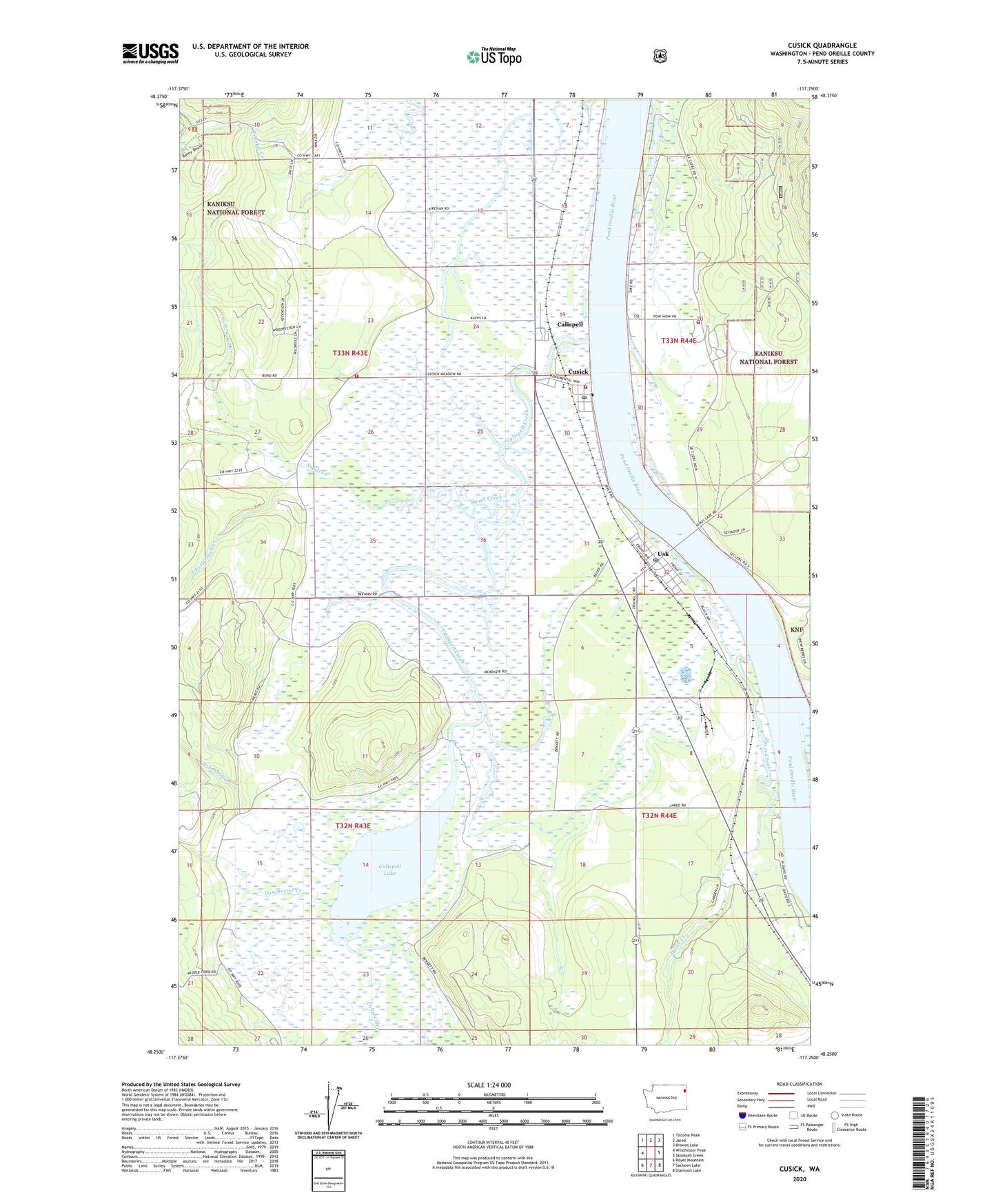
Cusick Washington US Topo Map
Couldn't load pickup availability
Also explore the Cusick Forest Service Topo of this same quad for updated USFS data
2023 topographic map quadrangle Cusick in the state of Washington. Scale: 1:24000. Based on the newly updated USGS 7.5' US Topo map series, this map is in the following counties: Pend Oreille. The map contains contour data, water features, and other items you are used to seeing on USGS maps, but also has updated roads and other features. This is the next generation of topographic maps. Printed on high-quality waterproof paper with UV fade-resistant inks.
Quads adjacent to this one:
West: Winchester Peak
Northwest: Tacoma Peak
North: Jared
Northeast: Browns Lake
East: Skookum Creek
Southeast: Diamond Lake
South: Sacheen Lake
Southwest: Boyer Mountain
This map covers the same area as the classic USGS quad with code o48117c3.
Contains the following named places: Bess Herian Elementary School, Calispel Valley Library, Calispell, Calispell Creek, Calispell Lake, Calispell Lake Dam, Cusick, Cusick Fire Department, Cusick Junior Senior High School, Cusick Post Office, Davis Creek, East Fork Small Creek, Indian Community Hall, Kalispel Reservation, Kalispel Tribal Public Safety Department, Kirchan, Newport Division, Newport Ranger District, Onserud Airfield, Our Lady of Sorrows, Pend Oreille Fire District 4 Station 44, Skookum Creek, Small Creek, South Fork Small Creek, Town of Cusick, Usk, Usk Post Office, Winchester Creek, ZIP Code: 99180