MyTopo
Elk Washington US Topo Map
Couldn't load pickup availability
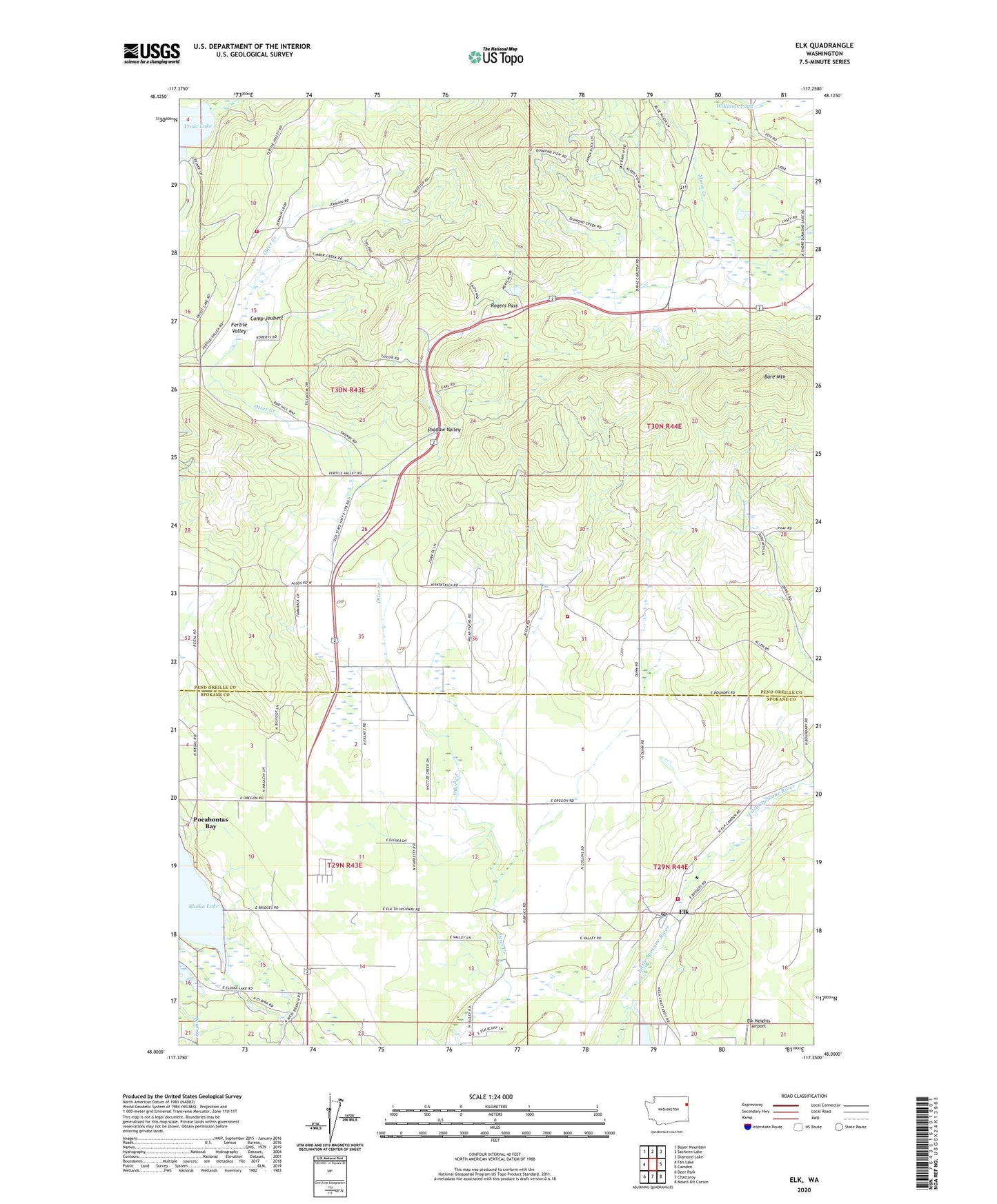
2023 topographic map quadrangle Elk in the state of Washington. Scale: 1:24000. Based on the newly updated USGS 7.5' US Topo map series, this map is in the following counties: Pend Oreille, Spokane. The map contains contour data, water features, and other items you are used to seeing on USGS maps, but also has updated roads and other features. This is the next generation of topographic maps. Printed on high-quality waterproof paper with UV fade-resistant inks.
Quads adjacent to this one:
West: Fan Lake
Northwest: Boyer Mountain
North: Sacheen Lake
Northeast: Diamond Lake
East: Camden
Southeast: Mount Kit Carson
South: Chattaroy
Southwest: Deer Park
This map covers the same area as the classic USGS quad with code o48117a3.
Contains the following named places: Bare Mountain, Camp Hager, Camp Joubert, Elk, Elk Community Church, Elk Heights Airport, Elk Post Office, Fertile Valley, Grays Landing, Koenig Dam, Peaceful Valley Church, Pend Oreille State Park, Pocahontas Bay, Reflection Lake North Dam, Rogers Pass, Shadow Valley, South Pend Oreille Fire and Rescue Station 35 - Camden, South Pend Oreille Fire and Rescue Station 71 - Fertile Valley, Spokane County Fire District 4 Station 43 Elk, The Open Bible Country Church, Trout Lake, Williams Pond, Williams Pond Dam, ZIP Code: 99009