MyTopo
Buckley Washington US Topo Map
Couldn't load pickup availability
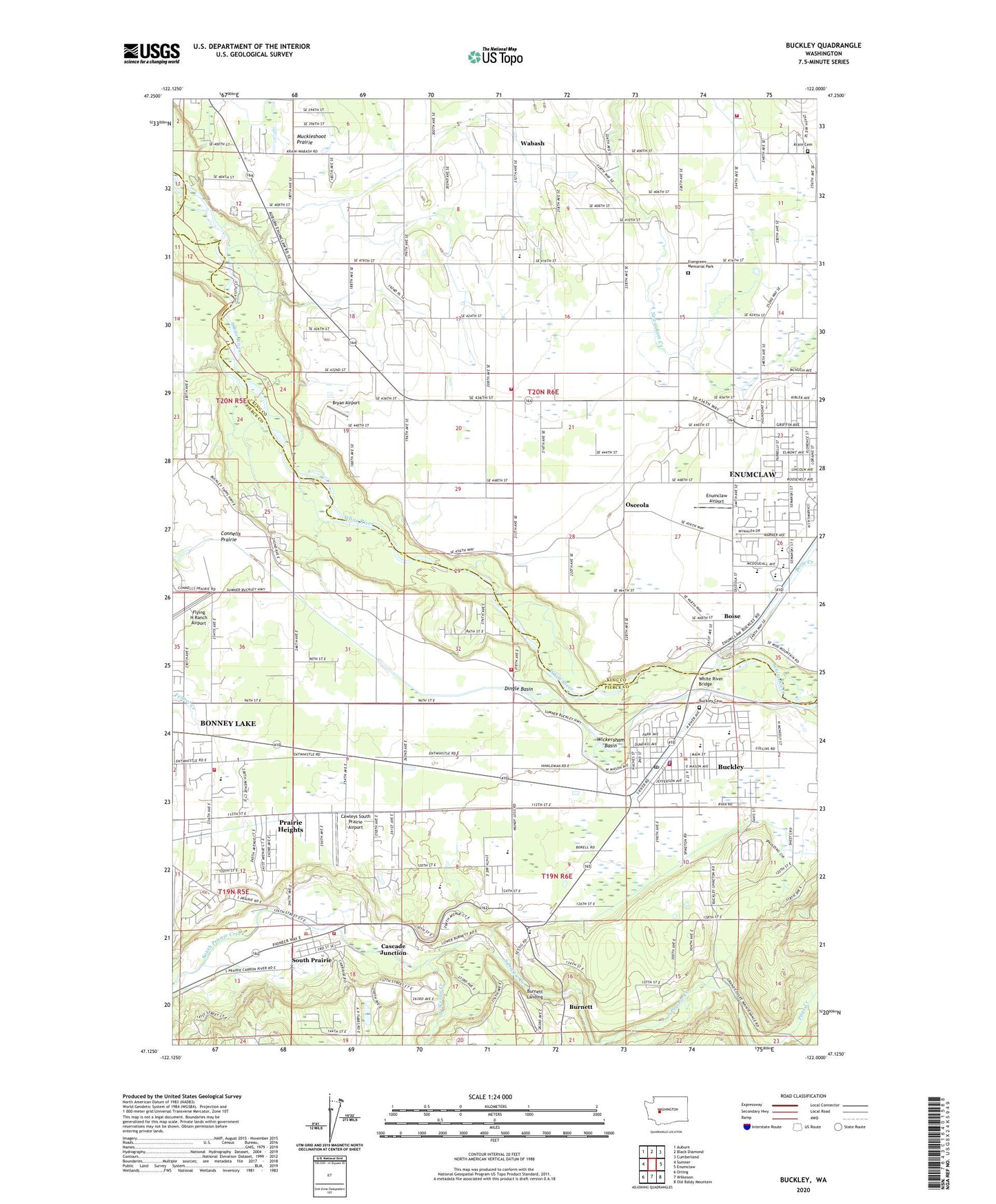
2023 topographic map quadrangle Buckley in the state of Washington. Scale: 1:24000. Based on the newly updated USGS 7.5' US Topo map series, this map is in the following counties: King, Pierce. The map contains contour data, water features, and other items you are used to seeing on USGS maps, but also has updated roads and other features. This is the next generation of topographic maps. Printed on high-quality waterproof paper with UV fade-resistant inks.
Quads adjacent to this one:
West: Sumner
Northwest: Auburn
North: Black Diamond
Northeast: Cumberland
East: Enumclaw
Southeast: Old Baldy Mountain
South: Wilkeson
Southwest: Orting
This map covers the same area as the classic USGS quad with code o47122b1.
Contains the following named places: Boise, Boise Creek, Bryan Airport, Buckley, Buckley Cemetery, Buckley Division, Buckley Police Department, Buckley Post Office, Buckley Sewage Treatment Plant, Buckley Shopping Center, Burnett, Burnett Landing, Cascade Junction, Cawleys South Prairie Airport, Cedar River Academy, City of Buckley, City of Buckley Fire Department, Connells Prairie, Dingle Basin, East Pierce Fire and Rescue Station 116 Foothills, East Pierce Fire and Rescue Station 119 South Prairie, East Pierce Fire and Rescue Station 121 Buckley, Elk Ridge Elementary School, Enumclaw Airport, Enumclaw Christian School, Enumclaw High School, Enumclaw Middle School, Enumclaw School District Office, Enumclaw Wastewater Treatment Plant, Evergreen Memorial Park, Farmers Park, Finnish Hall, Flying H Ranch Airport, Foothills Elementary School, Gateway Christian School, Glacier Middle School, Golden Valley Mobile Home Park, Holy Cross Cemetery, King County Fire Protection District 44 Mountain View Fire and Rescue Station 94, King County Fire Protection District Enumclaw Fire Department Station 3, King County Medic One, Krain Cemetery, Little Farmers Learning Center, Mahler Park, Marion Grange, Meadowbrook Mobile Home Park, Mount Rainier Shopping Plaza, Mountain Meadow Elementary School, Mountplains Rainier Mobile Home Park, Muckleshoot Indian Tribe White River Hatchery, Muckleshoot Prairie, Osceola, Pierce County Fire Protection District 12, Prairie Heights Census Designated Place, Rainbow Connection Daycare Center, Sandy Acres Mobile Home Park, Seventh Day Adventist School, Shilo Mobile Home Park, South Prairie, Southwood Elementary School, Spiketon, Sunrise Elementary School, Sunrise Grange, Town of South Prairie, Wabash, Westwood Elementary School, White River Bridge, White River Diversion Dam, White River Elementary School, White River High School, White River Junior and Senior High School, White River Middle School, Wickersham Basin, Wickersham Elementary School, Wickersham School, Wilkeson Creek, ZIP Codes: 98321, 98385