MyTopo
Enumclaw Washington US Topo Map
Couldn't load pickup availability
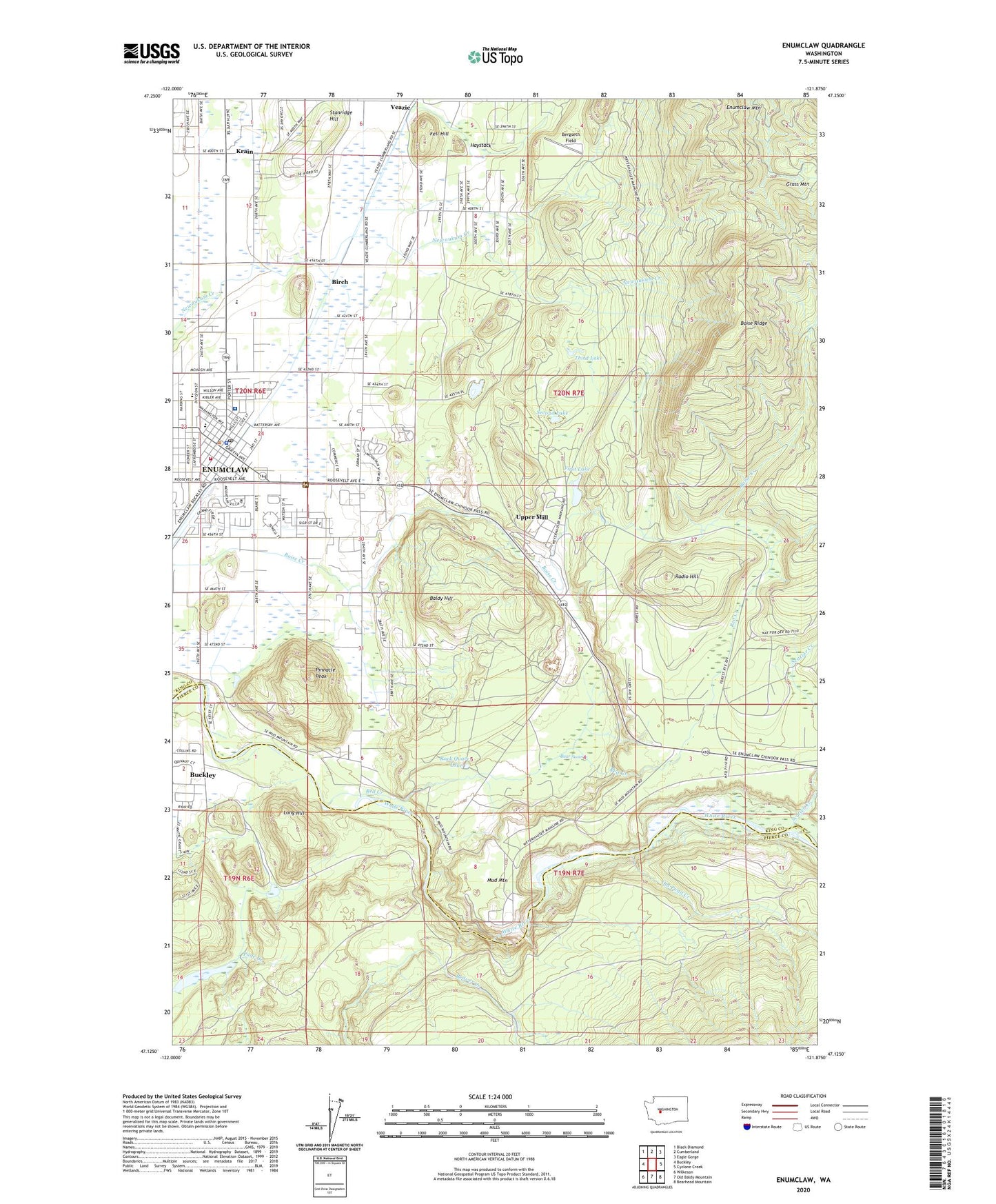
2023 topographic map quadrangle Enumclaw in the state of Washington. Scale: 1:24000. Based on the newly updated USGS 7.5' US Topo map series, this map is in the following counties: King, Pierce. The map contains contour data, water features, and other items you are used to seeing on USGS maps, but also has updated roads and other features. This is the next generation of topographic maps. Printed on high-quality waterproof paper with UV fade-resistant inks.
Quads adjacent to this one:
West: Buckley
Northwest: Black Diamond
North: Cumberland
Northeast: Eagle Gorge
East: Cyclone Creek
Southeast: Bearhead Mountain
South: Old Baldy Mountain
Southwest: Wilkeson
This map covers the same area as the classic USGS quad with code o47121b8.
Contains the following named places: Baldy Hill, Bear Swamp, Bergseth Field, Birch, Boise Ridge, Byron Kibler Elementary School, Circle H Mobile Home Park, City of Enumclaw, Collins Alternative Programs School, Country Playhouse Learning Center, Crystalaire Mobile Home Park, Enumclaw, Enumclaw Community Church, Enumclaw Golf Course, Enumclaw Junior High School, Enumclaw Police Department, Enumclaw Post Office, Evergreen Enumclaw Health and Rehabilitation Center, Fell Hill, First Lake, Haystack, J J Smith Elementary School, KENU-AM (Enumclaw), King County Enumclaw Park, King County Fairgrounds, King County Fire Protection District 28 Enumclaw Fire Department Station 1, Krain, Long Hill, Mountain Villa Mobile Manor, Mud Mountain, Mud Mountain Dam, Mud Mountain Lake, Old Pond Creek, Pinnacle Peak, Radio Hill, Rainier State School, Red Creek, Rock Quarry Lake, Saint Elizabeth Hospital, Scatter Creek, Second Lake, Stanridge Hill, Third Lake, Thunder Mountain Middle School, Upper Mill, Veazie, White River Mill Pond, White River Mill Pond Dam, White River Ranger Station, ZIP Code: 98022