MyTopo
Orting Washington US Topo Map
Couldn't load pickup availability
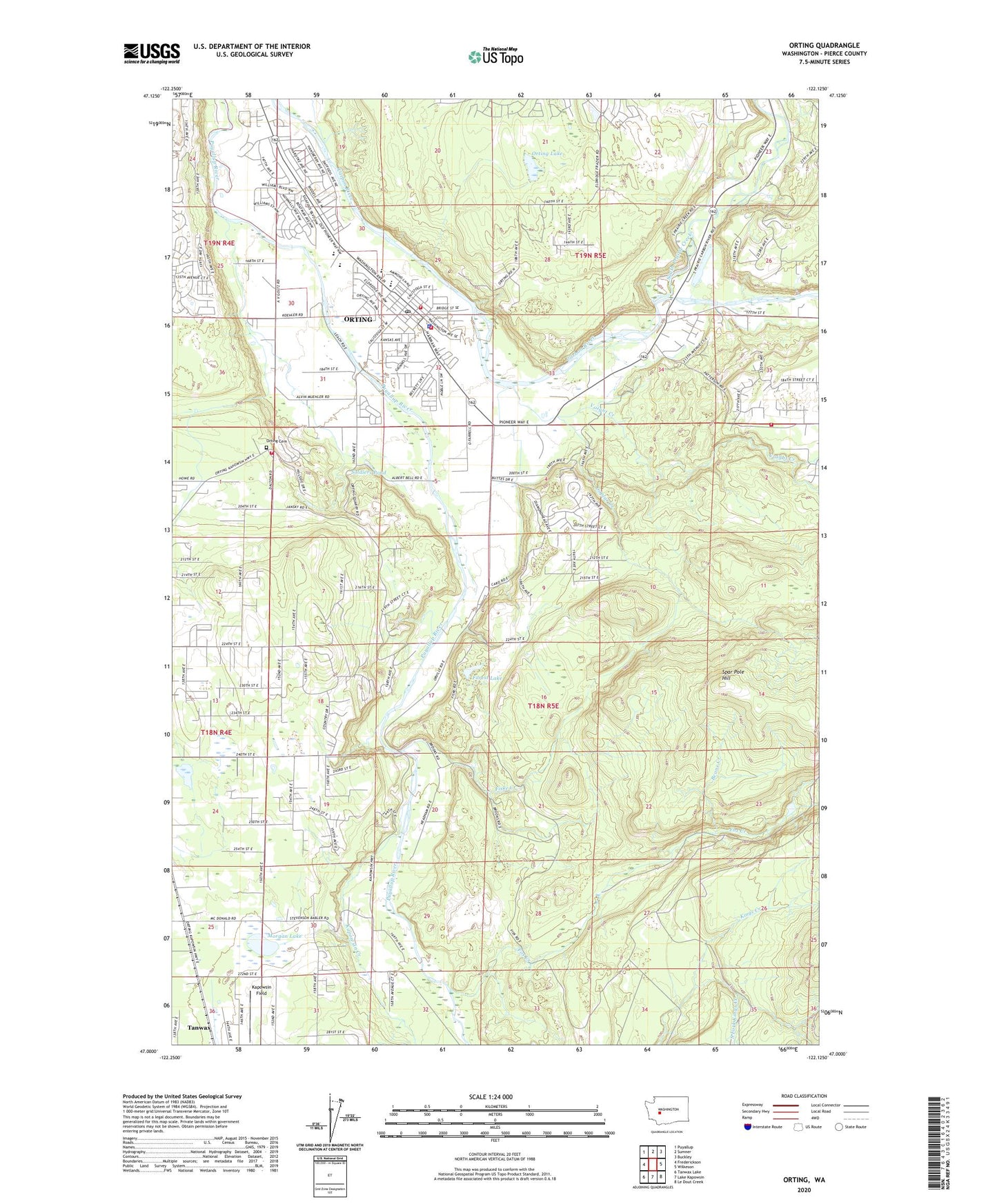
2023 topographic map quadrangle Orting in the state of Washington. Scale: 1:24000. Based on the newly updated USGS 7.5' US Topo map series, this map is in the following counties: Pierce. The map contains contour data, water features, and other items you are used to seeing on USGS maps, but also has updated roads and other features. This is the next generation of topographic maps. Printed on high-quality waterproof paper with UV fade-resistant inks.
Quads adjacent to this one:
West: Frederickson
Northwest: Puyallup
North: Sumner
Northeast: Buckley
East: Wilkeson
Southeast: Le Dout Creek
South: Lake Kapowsin
Southwest: Tanwax Lake
This map covers the same area as the classic USGS quad with code o47122a2.
Contains the following named places: Beane Creek, City of Orting, Coplar Creek, Croker, Fiske Creek, Forest Lake, Fox Creek, High Cedars Golf Club, Kapowsin Creek, Kapowsin Field, Morgan Lake, Mountain View Estates Mobile Home Park, Orting, Orting Cemetery, Orting High School, Orting Lake, Orting Middle School, Orting Police Department, Orting Post Office, Orting Primary School, Orting Sewage Treatment Plant, Pierce County, Pierce County Fire District 18 / Orting Valley Fire and Rescue Station 1, Pierce County Fire District 18 / Orting Valley Fire and Rescue Station 2, Pierce County Fire District 18 / Orting Valley Fire and Rescue Station 3, Pierce County Fire District 18 / Orting Valley Fire and Rescue Station 40 Headquarters, Ptarmigan Ridge Intermediate School, Puyallup River Fish Hatchery, Puyallup River Junction, Soldiers Pond, South Fork Kings Creek, South Prairie Creek, Spar Pole Hill, State Soldiers Home, Tanwax, Tehaleh Census Designated Place, Voight Creek, ZIP Code: 98360