MyTopo
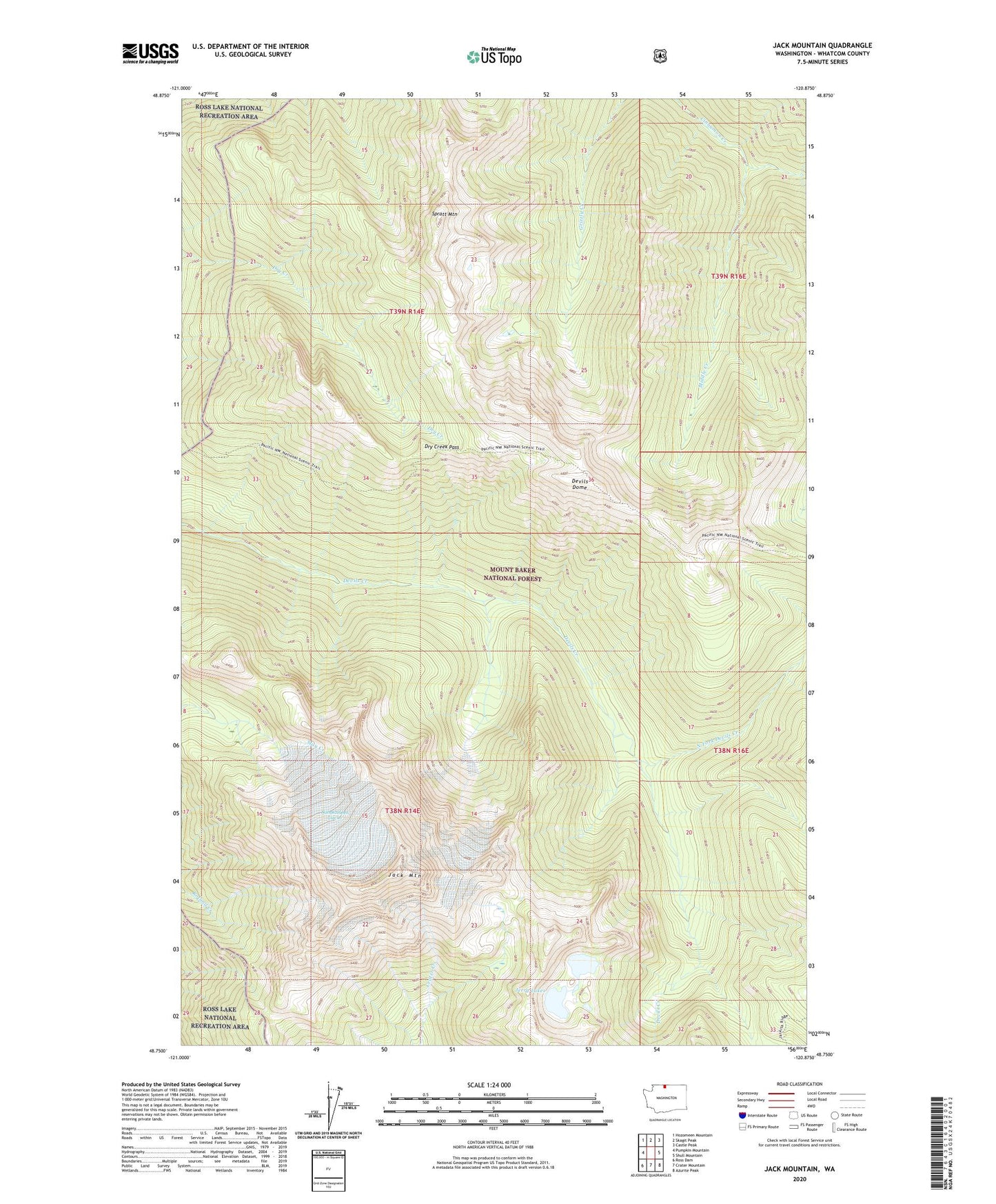
Jack Mountain Washington US Topo Map
Couldn't load pickup availability
Also explore the Jack Mountain Forest Service Topo of this same quad for updated USFS data
2023 topographic map quadrangle Jack Mountain in the state of Washington. Scale: 1:24000. Based on the newly updated USGS 7.5' US Topo map series, this map is in the following counties: Whatcom. The map contains contour data, water features, and other items you are used to seeing on USGS maps, but also has updated roads and other features. This is the next generation of topographic maps. Printed on high-quality waterproof paper with UV fade-resistant inks.
Quads adjacent to this one:
West: Pumpkin Mountain
Northwest: Hozomeen Mountain
North: Skagit Peak
Northeast: Castle Peak
East: Shull Mountain
Southeast: Azurite Peak
South: Crater Mountain
Southwest: Ross Dam
This map covers the same area as the classic USGS quad with code o48120g8.
Contains the following named places: Bear Skull Shelter, Devils Dome, Dry Creek Pass, Jack Mountain, Jerry Lakes, Middle Creek, Nohokomeen Glacier, North Fork Devils Creek, Spratt Mountain