MyTopo
Central Park Washington US Topo Map
Couldn't load pickup availability
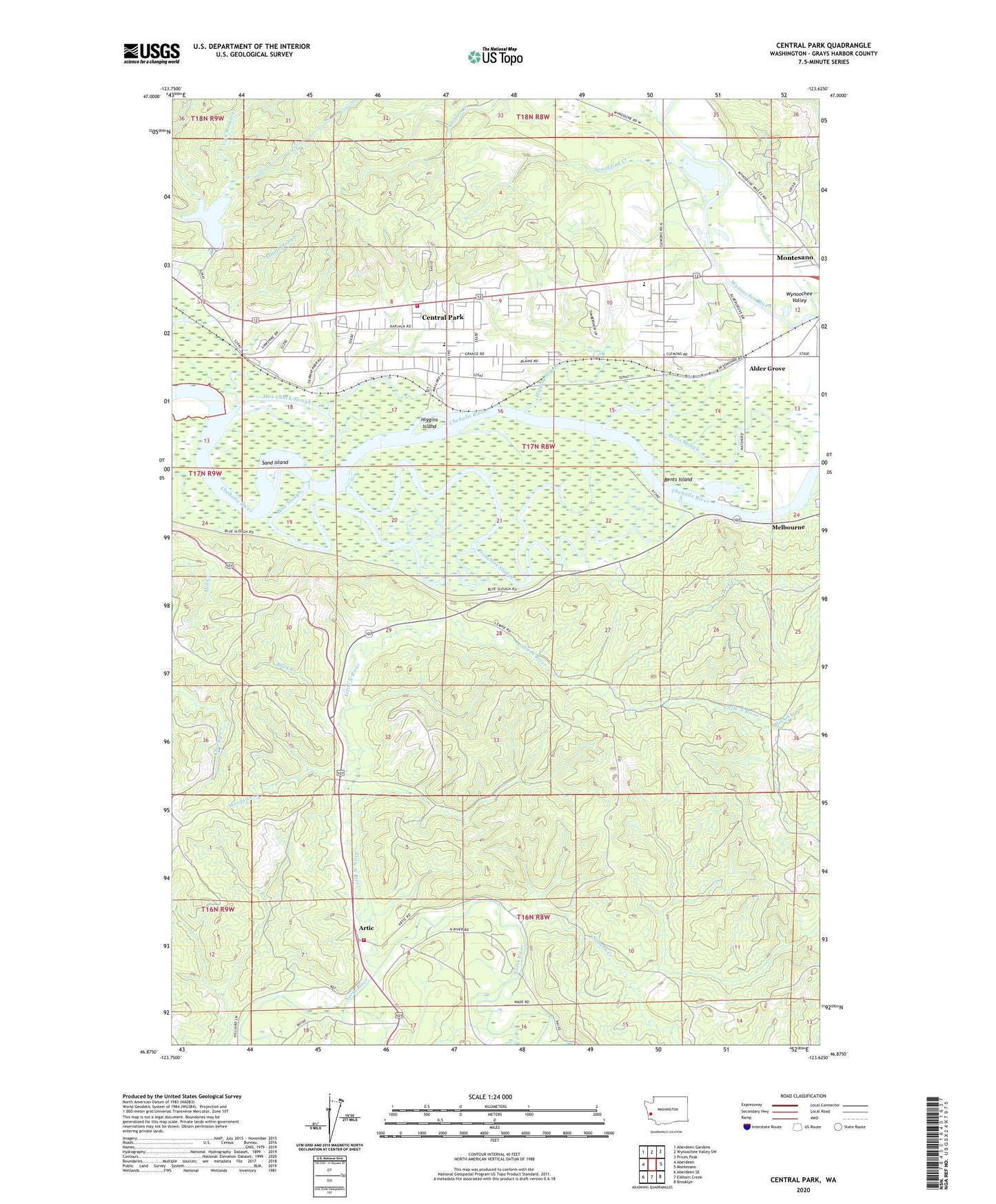
2023 topographic map quadrangle Central Park in the state of Washington. Scale: 1:24000. Based on the newly updated USGS 7.5' US Topo map series, this map is in the following counties: Grays Harbor. The map contains contour data, water features, and other items you are used to seeing on USGS maps, but also has updated roads and other features. This is the next generation of topographic maps. Printed on high-quality waterproof paper with UV fade-resistant inks.
Quads adjacent to this one:
West: Aberdeen
Northwest: Aberdeen Gardens
North: Wynoochee Valley SW
Northeast: Prices Peak
East: Montesano
Southeast: Brooklyn
South: Elkhorn Creek
Southwest: Aberdeen SE
This map covers the same area as the classic USGS quad with code o46123h6.
Contains the following named places: Aberdeen Church of Christ, Aberdeen Lake Dam, Alder Grove, Artic, Beck Creek, Bents Island, Bigelow Dam, Black Creek, Blue Slough, Brick Creek, Central Park, Central Park Baptist Church, Central Park Census Designated Place, Central Park Elementary School, Central Park Methodist Church, Central Park Neighborhood Church, Christian Life Fellowship Church, Country Estates Mobile Home Park, Crawfords Mobile Home Court, Geisler Creek, Grays Harbor Adventist Christian School, Grays Harbor Country Club, Grays Harbor Fire District 15 Artic Fire Station 1, Grays Harbor Fire District 2 Station 31 Central Park, Hidden Valley Mobile Home Park, Higgins Island, Higgins Slough, KDUX-FM (Aberdeen), KGHO-FM (Hoquiam), Lake Aberdeen, Lake Aberdeen Hatchery, Linkshire Market Mobile Home Park, Little North River, Melbourne, Mosquito Creek, Mox Chuck Slough, Oestreich Dam, Peels Slough, Preachers Slough, Salmon Creek, Sand Island, Spaulding Creek, Wynoochee East Quarry, Wynoochee Quarry, Wynoochee Valley