MyTopo
Elkhorn Creek Washington US Topo Map
Couldn't load pickup availability
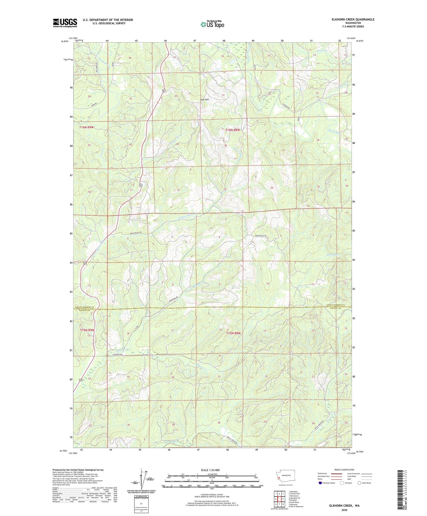
2023 topographic map quadrangle Elkhorn Creek in the state of Washington. Scale: 1:24000. Based on the newly updated USGS 7.5' US Topo map series, this map is in the following counties: Grays Harbor, Pacific. The map contains contour data, water features, and other items you are used to seeing on USGS maps, but also has updated roads and other features. This is the next generation of topographic maps. Printed on high-quality waterproof paper with UV fade-resistant inks.
Quads adjacent to this one:
West: Aberdeen SE
Northwest: Aberdeen
North: Central Park
Northeast: Montesano
East: Brooklyn
Southeast: East of Raymond
South: Raymond
Southwest: South Bend
This map covers the same area as the classic USGS quad with code o46123g6.
Contains the following named places: Joe Creek, North River Division, Rock Crusher Hill Quarry, Scar Hill, Tuttle Creek, West Fork Elkhorn Creek