MyTopo
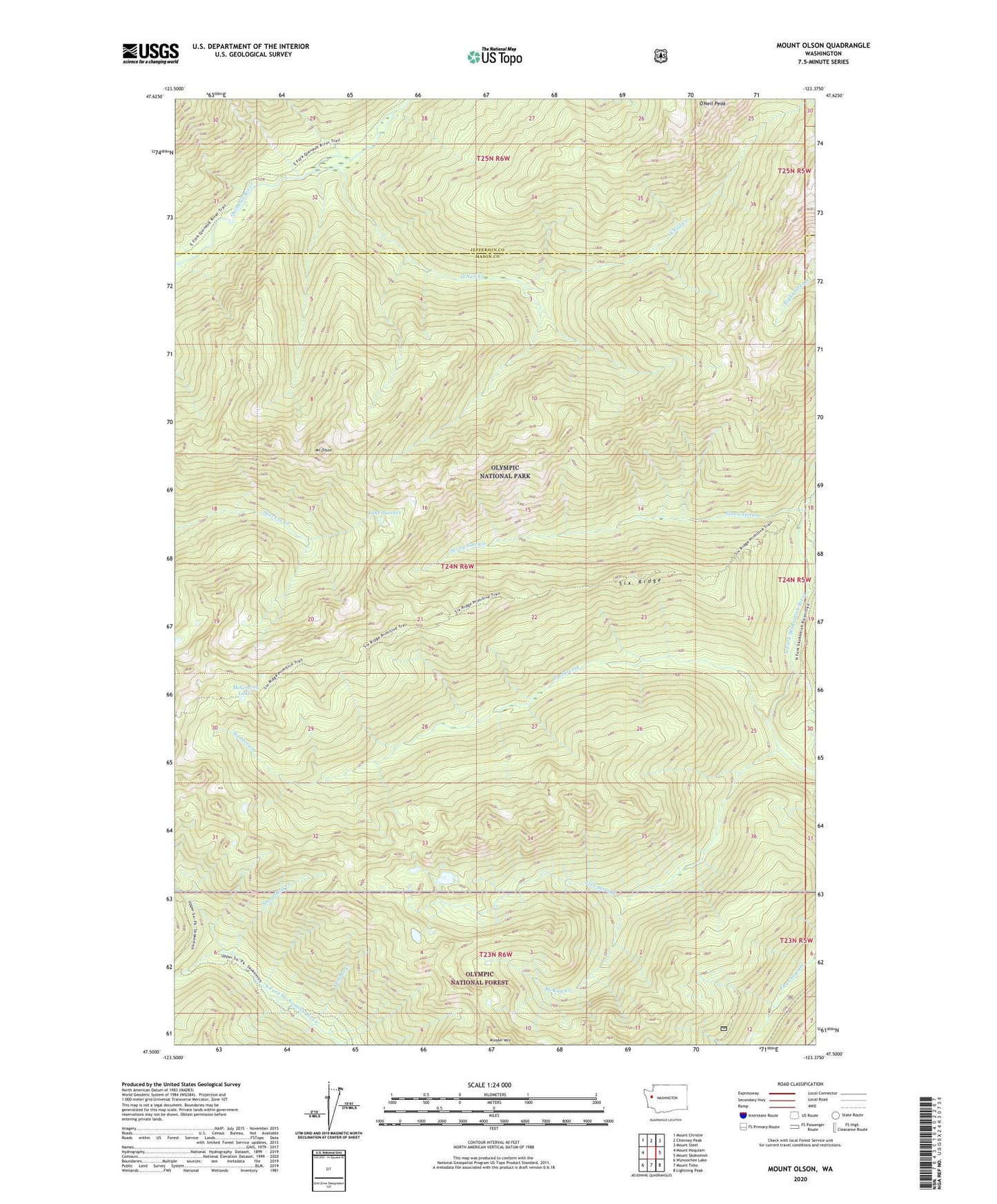
Mount Olson Washington US Topo Map
Couldn't load pickup availability
Also explore the Mount Olson Forest Service Topo of this same quad for updated USFS data
2023 topographic map quadrangle Mount Olson in the state of Washington. Scale: 1:24000. Based on the newly updated USGS 7.5' US Topo map series, this map is in the following counties: Mason, Jefferson. The map contains contour data, water features, and other items you are used to seeing on USGS maps, but also has updated roads and other features. This is the next generation of topographic maps. Printed on high-quality waterproof paper with UV fade-resistant inks.
Quads adjacent to this one:
West: Mount Hoquiam
Northwest: Mount Christie
North: Chimney Peak
Northeast: Mount Steel
East: Mount Skokomish
Southeast: Lightning Peak
South: Mount Tebo
Southwest: Wynoochee Lake
This map covers the same area as the classic USGS quad with code o47123e4.
Contains the following named places: Belview Shelter, Big Log Camp, Donahue Creek, Five Stream, Lake Success, Madeline Creek, McGravey Lakes, McKay Creek, Mount Olson, O'Neil Creek, O'Neil Creek Shelter, O'Neil Peak, Seven Stream, Six Ridge, Six Stream, Snowfield Creek, Tumble Creek, Wonder Mountain Wilderness