MyTopo
Clallam Bay Washington US Topo Map
Couldn't load pickup availability
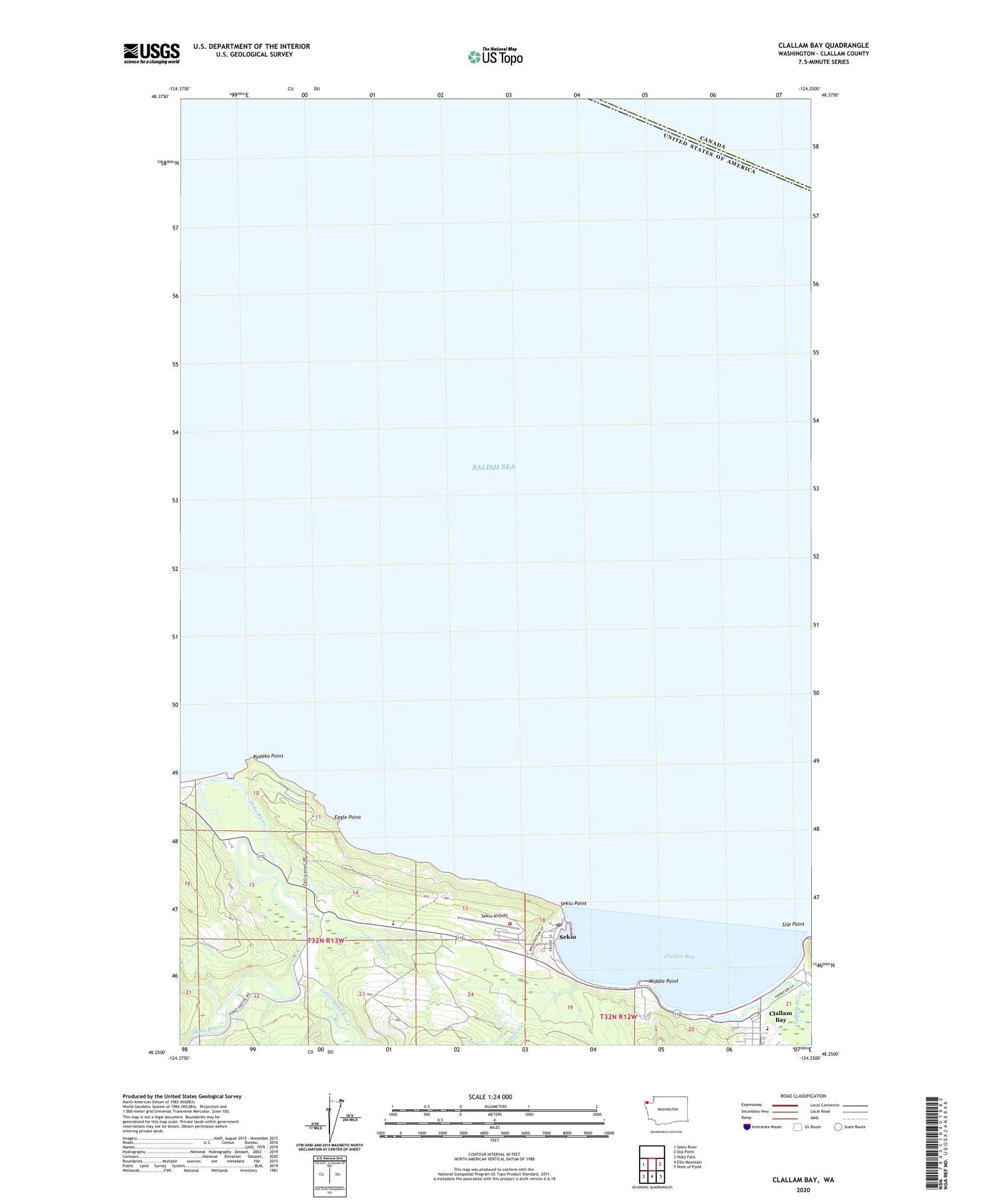
2023 topographic map quadrangle Clallam Bay in the state of Washington. Scale: 1:24000. Based on the newly updated USGS 7.5' US Topo map series, this map is in the following counties: Clallam. The map contains contour data, water features, and other items you are used to seeing on USGS maps, but also has updated roads and other features. This is the next generation of topographic maps. Printed on high-quality waterproof paper with UV fade-resistant inks.
Quads adjacent to this one:
West: Sekiu River
East: Slip Point
Southeast: West of Pysht
South: Ellis Mountain
Southwest: Hoko Falls
This map covers the same area as the classic USGS quad with code o48124c3.
Contains the following named places: Aview Mobile Home Park, Bayview Mobile Park, Bayview Recreational Vehicle Park, Clallam Bay, Clallam Bay Census Designated Place, Clallam Bay Presbyterian Church, Clallam Bay Public Library, Clallam Bay School, Clallam Bay Sewage Treatment Plant, Clallam County Fire District 5 Station 2, Clallam River, Eagle Point, Falls Creek, Hoko, Hoko River, Kydaka Point, Lamb Creek, Little Hoko River, Middle Point, Olson's Resort Marina, Sams Trailer Park, Sekiu, Sekiu Airport, Sekiu Census Designated Place, Sekiu Point, Sekiu Post Office, Sekiu Sewage Treatment Plant, Slip Point, Slip Point Lighthouse