MyTopo
Sekiu River Washington US Topo Map
Couldn't load pickup availability
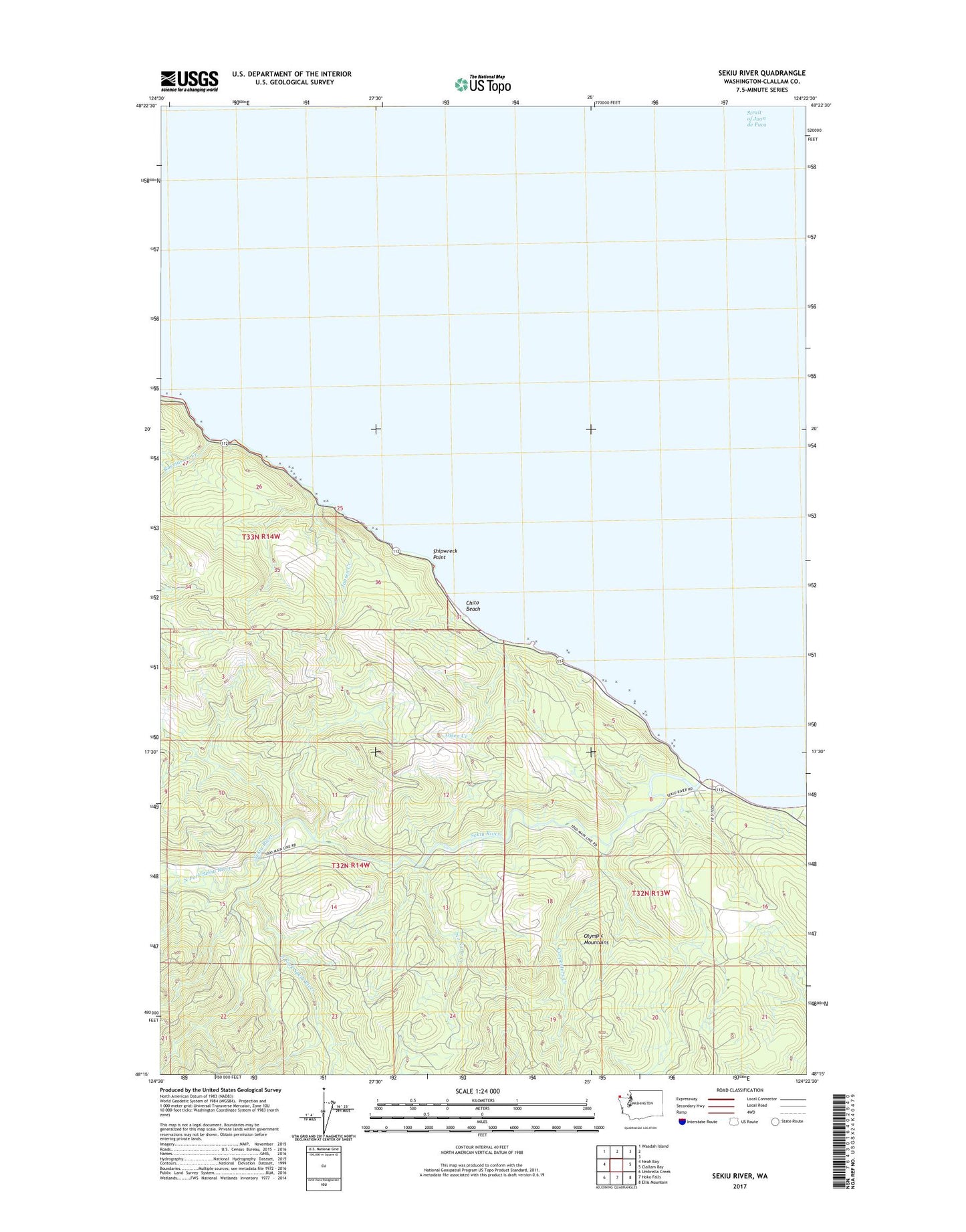
2023 topographic map quadrangle Sekiu River in the state of Washington. Scale: 1:24000. Based on the newly updated USGS 7.5' US Topo map series, this map is in the following counties: Clallam. The map contains contour data, water features, and other items you are used to seeing on USGS maps, but also has updated roads and other features. This is the next generation of topographic maps. Printed on high-quality waterproof paper with UV fade-resistant inks.
Quads adjacent to this one:
West: Neah Bay
Northwest: Waadah Island
East: Clallam Bay
Southeast: Ellis Mountain
South: Hoko Falls
Southwest: Umbrella Creek
This map covers the same area as the classic USGS quad with code o48124c4.
Contains the following named places: Carpenters Creek, Chito Beach, Crown Zellerback Landing Area, Jansen Creek, No Name Creek, North Fork Sekiu River, Olsen Creek, Rasmussen Creek, Sekiu River, Shipwreck Point, South Fork Sekiu River, ZIP Code: 98381