MyTopo
Colockum Pass SE Washington US Topo Map
Couldn't load pickup availability
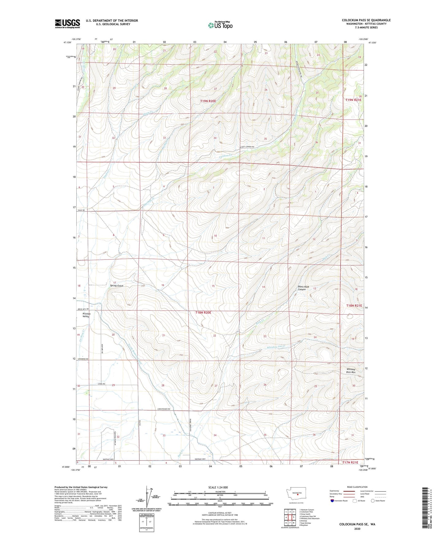
2023 topographic map quadrangle Colockum Pass SE in the state of Washington. Scale: 1:24000. Based on the newly updated USGS 7.5' US Topo map series, this map is in the following counties: Kittitas. The map contains contour data, water features, and other items you are used to seeing on USGS maps, but also has updated roads and other features. This is the next generation of topographic maps. Printed on high-quality waterproof paper with UV fade-resistant inks.
Quads adjacent to this one:
West: Colockum Pass SW
Northwest: Naneum Canyon
North: Colockum Pass
Northeast: Stray Gulch
East: Whiskey Dick Mountain
Southeast: Boylston
South: East Kittitas
Southwest: Kittitas
This map covers the same area as the classic USGS quad with code o47120a3.
Contains the following named places: Black Rock Canyon, Little Caribou Creek, North Branch Canal, Sheep Creek, Spring Gulch, Whiskey Jim Creek