MyTopo
Cougar Washington US Topo Map
Couldn't load pickup availability
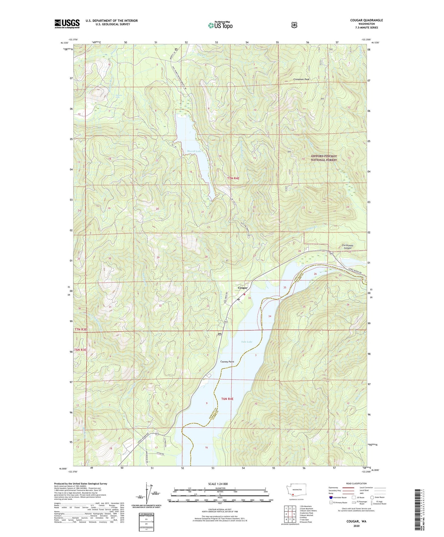
2020 topographic map quadrangle Cougar in the state of Washington. Scale: 1:24000. Based on the newly updated USGS 7.5' US Topo map series, this map is in the following counties: Cowlitz, Clark. The map contains contour data, water features, and other items you are used to seeing on USGS maps, but also has updated roads and other features. This is the next generation of topographic maps. Printed on high-quality waterproof paper with UV fade-resistant inks.
Quads adjacent to this one:
West: Lakeview Peak
Northwest: Elk Mountain
North: Goat Mountain
Northeast: Mount Saint Helens
East: Mount Mitchell
Southeast: Siouxon Peak
South: Yale Dam
Southwest: Amboy
Contains the following named places: Beaver Bay Campground, Beaver Bay Park, Christmas Canyon, Cinnamon Peak, Cooney Point, Cougar, Cougar Camp, Cougar Census Designated Place, Cougar Creek, Cougar Heliport, Cougar Park, Cougar Post Office, Cowlitz - Skamania Fire District 7 Station 2, Dog Creek, Dry Creek, Fossil Creek, Kalama Falls, Lost Creek, Merrill Lake, Merrill Lake Campground, Panamaker Creek, Swift Number Two Dam, The Mountain Airpark, West Fork Speelyai Creek, Yale Lake, Yale Park