MyTopo
Goat Mountain Washington US Topo Map
Couldn't load pickup availability
Also explore the Goat Mountain Forest Service Topo of this same quad for updated USFS data
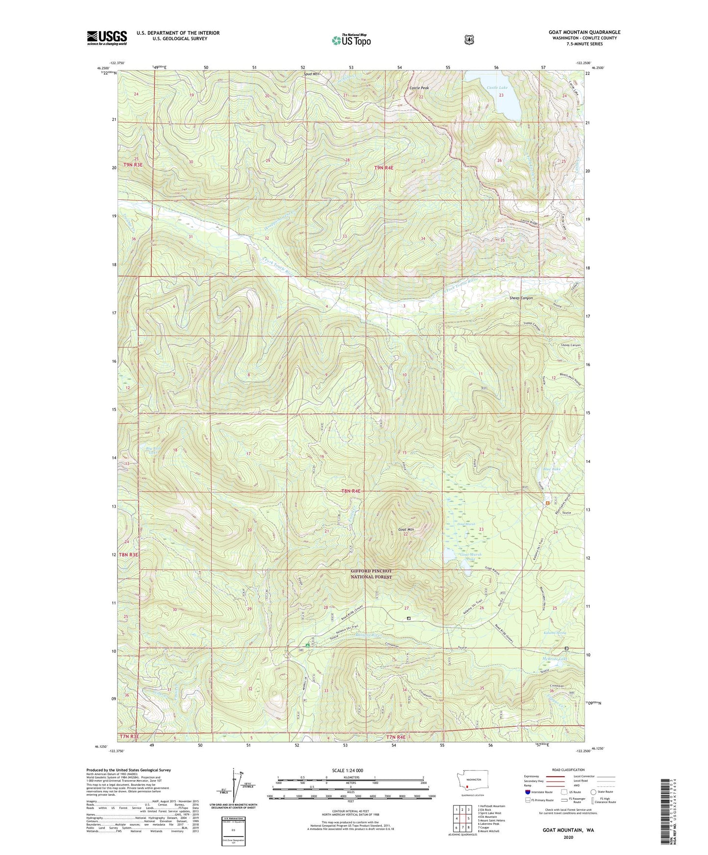
2023 topographic map quadrangle Goat Mountain in the state of Washington. Scale: 1:24000. Based on the newly updated USGS 7.5' US Topo map series, this map is in the following counties: Cowlitz. The map contains contour data, water features, and other items you are used to seeing on USGS maps, but also has updated roads and other features. This is the next generation of topographic maps. Printed on high-quality waterproof paper with UV fade-resistant inks.
Quads adjacent to this one:
West: Elk Mountain
Northwest: Hoffstadt Mountain
North: Elk Rock
Northeast: Spirit Lake West
East: Mount Saint Helens
Southeast: Mount Mitchell
South: Cougar
Southwest: Lakeview Peak
This map covers the same area as the classic USGS quad with code o46122b3.
Contains the following named places: Big Bull Lake, Blue Lake, Castle Creek Marsh, Castle Peak, Cedar Creek, Coldspring Creek, Disappointment Creek, Goat Marsh, Goat Marsh Lake, Goat Marsh Research Natural Area, Goat Mountain, Kalama River Trail, Kalama Spring, Kalama Workcenter, McBride Lake, Sheep Canyon, Sheep Canyon Viewpoint, Studebaker Creek, Toutle River Trail