MyTopo
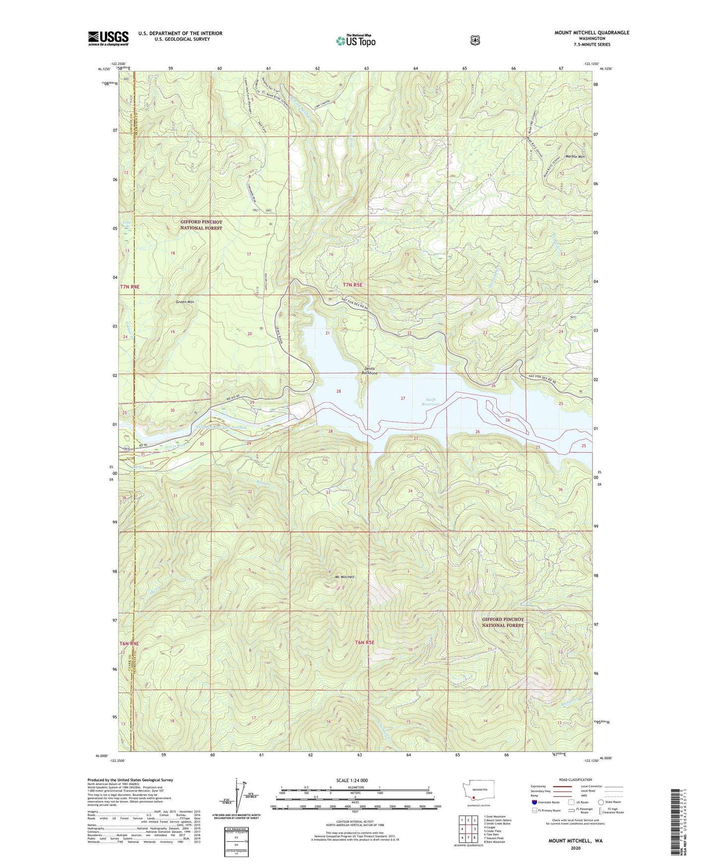
Mount Mitchell Washington US Topo Map
Couldn't load pickup availability
Also explore the Mount Mitchell Forest Service Topo of this same quad for updated USFS data
2023 topographic map quadrangle Mount Mitchell in the state of Washington. Scale: 1:24000. Based on the newly updated USGS 7.5' US Topo map series, this map is in the following counties: Skamania, Cowlitz, Clark. The map contains contour data, water features, and other items you are used to seeing on USGS maps, but also has updated roads and other features. This is the next generation of topographic maps. Printed on high-quality waterproof paper with UV fade-resistant inks.
Quads adjacent to this one:
West: Cougar
Northwest: Goat Mountain
North: Mount Saint Helens
Northeast: Smith Creek Butte
East: Cedar Flats
Southeast: Bare Mountain
South: Siouxon Peak
Southwest: Yale Dam
This map covers the same area as the classic USGS quad with code o46122a2.
Contains the following named places: Ape Cave Entrance, Ape Cave Skylight, Cougar Creek, Devils Backbone, Diamond Creek, Grass Lake, Green Mountain, Lava Cast Picnic Area, Marble Creek, Marble Mountain, Mount Mitchell, Mount Mitchell Lookout, Ole Creek, Rain Creek, Swift Creek, Swift Dam, Swift Dam Overlook, Swift Number Two Forebay, Swift Viewpoint, West Fork Swift Creek