
MyTopo
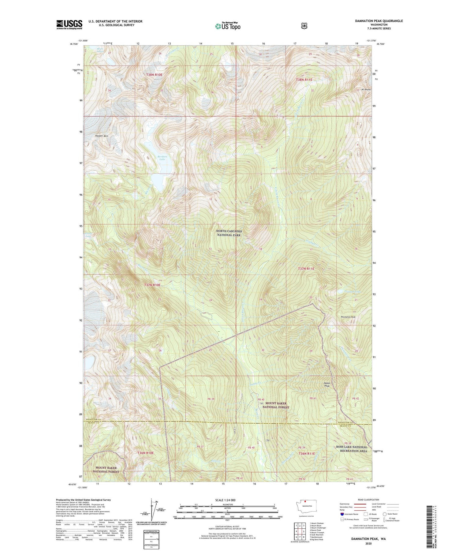
Damnation Peak Washington US Topo Map
Couldn't load pickup availability
Also explore the Damnation Peak Forest Service Topo of this same quad for updated USFS data
2023 topographic map quadrangle Damnation Peak in the state of Washington. Scale: 1:24000. Based on the newly updated USGS 7.5' US Topo map series, this map is in the following counties: Whatcom, Skagit. The map contains contour data, water features, and other items you are used to seeing on USGS maps, but also has updated roads and other features. This is the next generation of topographic maps. Printed on high-quality waterproof paper with UV fade-resistant inks.
Quads adjacent to this one:
West: Bacon Peak
Northwest: Mount Shuksan
North: Mount Blum
Northeast: Mount Challenger
East: Mount Triumph
Southeast: Big Devil Peak
South: Marblemount
Southwest: Sauk Mountain
This map covers the same area as the classic USGS quad with code o48121f4.
Contains the following named places: Berdeen Lake, Damnation Peak, East Fork Bacon Creek, Falls Creek, Hagan Mountain, Jumbo Creek, Mount Despair, Oakes Peak, Steelhead Creek, Triumph Creek, Triumph Lake


